Area Overview for OX2 0NA
Photos of OX2 0NA
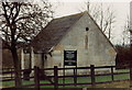
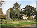
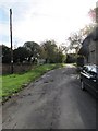

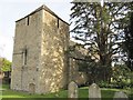


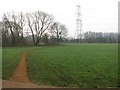
99 photos from this area
Area Information
Key information about the OX2 0NA including its size, population, and administrative classification.
- Area Type
- Postcode
- Area Size
- 19.1 hectares
- Population
- 2018
- Population Density
- 1072 people/km²
House Prices in OX2 0NA
43
Properties
£416,906
Average Sold Price
£64,500
Lowest Price
£1,285,000
Highest Price
Showing 43 properties
| Address | Type | Beds | Baths | Last Sale Price | Last Sale Date | |
|---|---|---|---|---|---|---|
| 26 North Hinksey Lane, North Hinksey Village, Oxford, OX2 0NA | Detached | 2 | 1 | £475,000 | Feb 2024 | |
| 50 North Hinksey Lane, North Hinksey Village, Oxford, OX2 0NA | Retail | 3 | 2 | £500,000 | Apr 2022 | |
| 31 North Hinksey Lane, North Hinksey Village, Oxford, OX2 0NA | Detached | 3 | 1 | £505,000 | Feb 2021 | |
| 68 North Hinksey Lane, North Hinksey Village, Oxford, OX2 0NA | Semi-detached | 3 | 1 | £340,000 | Apr 2019 | |
| 32 North Hinksey Lane, North Hinksey Village, Oxford, OX2 0NA | Maisonette | 2 | 1 | £345,000 | Feb 2019 | |
| Hinksey House, North Hinksey Village, Oxford, OX2 0NA | Detached | 5 | 4 | £1,285,000 | Dec 2017 | |
| 56 North Hinksey Lane, North Hinksey Village, Oxford, OX2 0NA | Semi-detached | 3 | - | £325,000 | Dec 2014 | |
| Ferry Cottage, 7 North Hinksey Lane, North Hinksey Village, Oxford, OX2 0NA | Detached | 5 | - | £999,999 | Jul 2014 | |
| 29 North Hinksey Lane, North Hinksey Village, Oxford, OX2 0NA | Detached | 5 | 2 | £640,000 | Nov 2012 | |
| 27 North Hinksey Lane, North Hinksey Village, Oxford, OX2 0NA | house | - | - | £250,000 | Jan 2012 |
Page 1 of 5
Energy Efficiency in OX2 0NA
Amenities
Schools
| Rank | School | Type | Entry gender | Ages |
|---|
Explore more schools in this area
Go to Schools tabDemographics
Household Size
Family (3-5 people)
most common
Accommodation Type
Houses
most common
Tenure
74
majority
Ethnic Group
White
most common
Religion
N/A
most common
Household Composition
N/A
most common
Age
47
median
Adults (30-64 years)
most common
Household Deprivation
N/A
with no deprivation
NS-SEC
45
in Lower managerial occupations
Explore more demographic insights in this area
Go to Demographics tabPlanning
Planning Constraints
- Flood RiskPremium
- Ramsar Wetland SitesPremium
- Area of Outstanding Natural BeautyPremium
- Protected Nature ReservePremium
- Protected WoodlandPremium