Area Overview for OX2 0HA
Photos of OX2 0HA
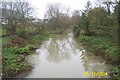
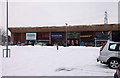
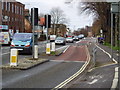
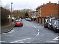

100 photos from this area
Area Information
Key information about the OX2 0HA including its size, population, and administrative classification.
- Area Type
- Postcode
- Area Size
- 11.4 hectares
- Population
- 1960
- Population Density
- 430 people/km²
House Prices in OX2 0HA
7
Properties
-
Average Sold Price
-
Lowest Price
-
Highest Price
Showing 7 properties
| Address | Type | Beds | Baths | Last Sale Price | Last Sale Date | |
|---|---|---|---|---|---|---|
| Unit 2, Lamarsh Road, Oxford, OX2 0HA | Industrial | - | - | - | - | |
| Wickes Home Improvement, 219 Botley Road, Oxford, OX2 0HA | Retail | - | - | - | - | |
| Units 1 And 2 And 3, Lamarsh Road, Oxford, OX2 0HA | Industrial | - | - | - | - | |
| Toys R Us, Unit 1 Toys R Us And Car Park, 219 Botley Road, Oxford, OX2 0HA | retail_financial | - | - | - | - | |
| Amazon, Electronic Delivery Locker At, 219 Botley Road, Oxford, OX2 0HA | Retail | - | - | - | - | |
| Unit 1 And Unit 2, Lamarsh Road, Oxford, OX2 0HA | office_workshop | - | - | - | - | |
| Units 2 And 3, Lamarsh Road And Former Hartwells Site, Botley Road, Oxford, OX2 0HA | retail_financial | - | - | - | - |
Energy Efficiency in OX2 0HA
Amenities
Schools
| Rank | School | Type | Entry gender | Ages |
|---|
Explore more schools in this area
Go to Schools tabDemographics
Household Size
Family (3-5 people)
most common
Accommodation Type
Houses
most common
Tenure
53
majority
Ethnic Group
White
most common
Religion
N/A
most common
Household Composition
N/A
most common
Age
47
median
Adults (30-64 years)
most common
Household Deprivation
N/A
with no deprivation
NS-SEC
49
in Lower managerial occupations
Explore more demographic insights in this area
Go to Demographics tabPlanning
Planning Constraints
- Flood RiskPremium
- Ramsar Wetland SitesPremium
- Area of Outstanding Natural BeautyPremium
- Protected Nature ReservePremium
- Protected WoodlandPremium