Area Overview for OX2 0BH
Photos of OX2 0BH
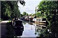
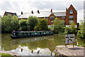
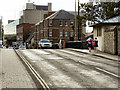
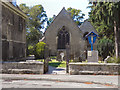
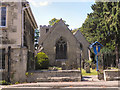
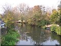
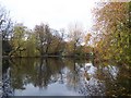
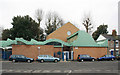
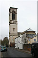
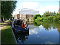
100 photos from this area
Area Information
Key information about the OX2 0BH including its size, population, and administrative classification.
- Area Type
- Postcode
- Area Size
- 5916 m²
- Population
- 1533
- Population Density
- 1877 people/km²
House Prices in OX2 0BH
23
Properties
£400,600
Average Sold Price
£206,000
Lowest Price
£773,000
Highest Price
Showing 23 properties
| Address | Type | Beds | Baths | Last Sale Price | Last Sale Date | |
|---|---|---|---|---|---|---|
| 47 West Street, Oxford, OX2 0BH | Terraced | 3 | 2 | £500,000 | Dec 2019 | |
| 61 West Street, Oxford, OX2 0BH | Terraced | 3 | 1 | £675,000 | Nov 2017 | |
| 56 West Street, Oxford, OX2 0BH | Terraced | 3 | 3 | £773,000 | Apr 2017 | |
| Willow Barn, 45A West Street, Oxford, OX2 0BH | Detached | 2 | 2 | £285,000 | Jul 2013 | |
| 48 West Street, Oxford, OX2 0BH | Terraced | 2 | 1 | £345,000 | May 2013 | |
| 57 West Street, Oxford, OX2 0BH | house | - | - | £590,000 | Aug 2010 | |
| 63 West Street, Oxford, OX2 0BH | house | - | - | £206,000 | Jun 2010 | |
| 44 West Street, Oxford, OX2 0BH | Terraced | 2 | 1 | £340,000 | May 2010 | |
| 59 West Street, Oxford, OX2 0BH | Unknown | - | - | £437,500 | Jun 2006 | |
| 50 West Street, Oxford, OX2 0BH | Terraced | - | - | £242,000 | Apr 2004 |
Page 1 of 3
Energy Efficiency in OX2 0BH
Amenities
Schools
| Rank | School | Type | Entry gender | Ages |
|---|
Explore more schools in this area
Go to Schools tabDemographics
Household Size
One person
most common
Accommodation Type
Houses
most common
Tenure
46
majority
Ethnic Group
White
most common
Religion
N/A
most common
Household Composition
N/A
most common
Age
47
median
Adults (30-64 years)
most common
Household Deprivation
N/A
with no deprivation
NS-SEC
54
in Lower managerial occupations
Explore more demographic insights in this area
Go to Demographics tabPlanning
Planning Constraints
- Flood RiskPremium
- Ramsar Wetland SitesPremium
- Area of Outstanding Natural BeautyPremium
- Protected Nature ReservePremium
- Protected WoodlandPremium