Area Overview for OX2 0AL
Photos of OX2 0AL


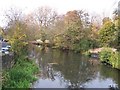


100 photos from this area
Area Information
Key information about the OX2 0AL including its size, population, and administrative classification.
- Area Type
- Postcode
- Area Size
- 7812 m²
- Population
- 1533
- Population Density
- 1877 people/km²
House Prices in OX2 0AL
46
Properties
£325,295
Average Sold Price
£150,000
Lowest Price
£745,000
Highest Price
Showing 46 properties
| Address | Type | Beds | Baths | Last Sale Price | Last Sale Date | |
|---|---|---|---|---|---|---|
| 48 Mill Street, Oxford, OX2 0AL | house | - | - | £745,000 | Sep 2024 | |
| 59 Mill Street, Oxford, OX2 0AL | Terraced | 4 | 1 | £585,000 | May 2023 | |
| 56 Mill Street, Oxford, OX2 0AL | Terraced | 2 | 1 | £485,000 | May 2022 | |
| 57 Mill Street, Oxford, OX2 0AL | house | 3 | 2 | £495,000 | Jun 2021 | |
| 70 Mill Street, Oxford, OX2 0AL | Terraced | 2 | 1 | £410,000 | Apr 2018 | |
| 47 Mill Street, Oxford, OX2 0AL | Terraced | 3 | - | £520,000 | Aug 2015 | |
| 42 Mill Street, Oxford, OX2 0AL | Terraced | 4 | 2 | £393,500 | Mar 2014 | |
| 71 Mill Street, Oxford, OX2 0AL | Terraced | 3 | - | £375,000 | Jan 2014 | |
| 79C Mill Street, Oxford, OX2 0AL | Terraced | 2 | 1 | £335,000 | Apr 2013 | |
| 78 Mill Street, Oxford, OX2 0AL | house | - | - | £315,000 | Apr 2013 |
Page 1 of 5
Energy Efficiency in OX2 0AL
Amenities
Schools
| Rank | School | Type | Entry gender | Ages |
|---|
Explore more schools in this area
Go to Schools tabDemographics
Household Size
One person
most common
Accommodation Type
Houses
most common
Tenure
46
majority
Ethnic Group
White
most common
Religion
N/A
most common
Household Composition
N/A
most common
Age
47
median
Adults (30-64 years)
most common
Household Deprivation
N/A
with no deprivation
NS-SEC
54
in Lower managerial occupations
Explore more demographic insights in this area
Go to Demographics tabPlanning
Planning Constraints
- Flood RiskPremium
- Ramsar Wetland SitesPremium
- Area of Outstanding Natural BeautyPremium
- Protected Nature ReservePremium
- Protected WoodlandPremium