Area Overview for OX18 9EP
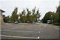
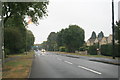
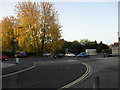
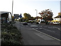
Photos of OX18 9EP


Area Information
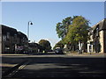
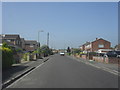
Living in OX18 9EP means residing within a specific, small residential cluster characterised by a population of 1,573. This postcode covers a concentrated area where residents enjoy the quiet convenience of a small neighbourhood rather than the sprawl of a larger town. The location sits at a practical distance from major amenities while maintaining a sense of local distinctiveness. You will find that daily life revolves around the immediate community, with everything from shopping to leisure options within easy reach. The area functions as a functional residential zone, balancing proximity to larger services with a lower density living experience. This specific postcode offers a straightforward environment for those seeking a home away from the busiest city centres. The small population ensures that the area retains a manageable scale, meaning longer commute times to the city centre are less of a barrier given the local infrastructure. You are part of a defined group of neighbours in a setting that prioritises residence over commercial development. The layout supports a lifestyle where you can access essential services like supermarkets and an airport nearby, yet still enjoy the benefits of a contained living space. This makes OX18 9EP a viable option for buyers who want a stable, low-density environment with reliable access to broader transport and retail networks without being enveloped by them.
- Area Type
- Postcode
- Area Size
- Not available
- Population
- 1573
- Population Density
- 3334 people/km²
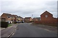
The property market in OX18 9EP is defined by a clear dominance of houses, with no data suggesting the presence of apartments or flats in this specific postcode. This housing stock caters primarily to individuals and families who value single-level living or the semi-outdoor space associated with detached and semi-detached properties. With 44 per cent of the population owning their homes, the market leans heavily towards owner-occupiers rather than landlords or investors. This high ownership rate usually correlates with a stable community where long-term residents shape the local character. For buyers looking in this area, the exclusive focus on houses means you will not find high-density conversion options or shared ownership schemes typical of larger town centres. The accommodation type data confirms that every property here is a house, ensuring consistency in building styles and garden potential. This homogeneity can make selling faster if you understand the market, as buyers know exactly what they are acquiring. You should expect higher initial purchase prices compared to apartment blocks because the scarcity of even detached houses in certain parts of Oxfordshire adds value. The low rental component suggests that buy-to-let investors play a minor role, reducing the likelihood of turnkey rental deals but offering a quiet street life. Your search here should prioritise condition over size, as the limited population of 1,573 means careful selection of serviceable homes is key.
House Prices in OX18 9EP
No properties found in this postcode.
Energy Efficiency in OX18 9EP
Lifestyle in OX18 9EP is defined by close access to major retail chains and essential services, ensuring convenience without the noise of a city centre. Within practical reach, you will find Morrisons Carterton, Asda Carterton, and Morrisons Daily, providing comprehensive shopping options for groceries and daily essentials. These five retail outlets ensure you can complete weekly shopping trips without leaving the district. For travel, the area is within easy reach of RAF Brize Norton, offering an airport nearby for occasional business trips or flights. This proximity to air transport connects residents to national networks while maintaining a local rhythm. The lifestyle here balances suburban comfort with the utility of nearby commercial hubs. You do not need to drive far to stock your cupboards at Morrisons Carterton or grab essentials at the Morrisons Daily. The presence of Asda Carterton adds variety to supermarket choices, allowing you to compare prices and product ranges. Having an airport nearby like RAF Brize Norton is particularly useful for professionals who need occasional quick departures. The combination of these amenities creates a self-sufficient environment where daily needs are met locally. You will appreciate the ability to walk or drive short distances to your required stores. The lack of mentioned leisure centres or parks in the immediate data suggests a focus on functional retail and transport rather than extensive recreational zones. Your evenings and weekends will likely involve local exploration or travel to the wider town centre.
Amenities
Schools
Families considering schools near OX18 9EP have access to Gateway Primary School. This institution serves as the main educational option for younger children residing within the postcode. The school holds a 'good' Ofsted rating, indicating that it meets national standards for teaching quality, behaviour, and student outcomes. Attendees benefit from a learning environment that has demonstrated solid performance in recent evaluations. The primary focus on one named school suggests that secondary education options are located further away, requiring bus or car travel for older children. The availability of a primary school with a positive Ofsted rating makes this area viable for families with school-aged children living on the primary level. You do not need to look further for early years education, as Gateway Primary School provides a recognised standard of tuition. The 'good' rating means you can expect competent leadership and effective staff without worrying about underperforming institutions. This singular option simplifies the transition for new residents, as there is no confusion over which primary academy or voluntary aided school serves the catchment area. While the data does not list secondary schools, the presence of a well-rated primary school indicates a functional local educational infrastructure that supports the 1,573 inhabitants. Parents in OX18 9EP can rely on Gateway Primary School for the start of their child's formal education journey.
| Rank | School | Type | Entry gender | Ages |
|---|---|---|---|---|
| 1 | Gateway Primary School | primary | N/A | N/A |
Explore more schools in this area
Go to Schools tabDemographics
The community in OX18 9EP reflects a mature demographic profile centred on adults aged between 30 and 64 years. The median age here is 47 years, indicating a population skewed towards middle and older adulthood. This age range suggests that the area attracts families who have established careers or empty-nesters seeking a quiet retreat. With 44 per cent of residents owning their homes, nearly half the community enjoys home ownership, which contrasts with rental markets that dominate other regions. The remaining households likely comprise renters or those in the process of purchasing property. Accommodation types in this postcode are exclusively houses, providing a distinct contrast to apartment-heavy zones found in larger urban areas. This focus on detached or semi-detached housing aligns with the preference of the 30 to 64-year-old demographic for private outdoor space and traditional home layouts. The predominant ethnic group is White, mirroring the broader national average and contributing to a culturally familiar residential atmosphere. The low diversity metrics do not detract from the quality of life but simply define the social and cultural composition of the neighbourhood. You will find a community accustomed to similar cultural backgrounds and life stages, creating a predictable and stable environment for new arrivals. This housing stock and age profile make the area particularly suitable for those seeking a conventional house rather than shared living or high-rise accommodation.
Household Size
Accommodation Type
Tenure
Ethnic Group
Religion
Household Composition
Age
Household Deprivation
NS-SEC
Explore more demographic insights in this area
Go to Demographics tabPlanning
Planning Constraints
- Flood RiskPremium
- Ramsar Wetland SitesPremium
- Area of Outstanding Natural BeautyPremium
- Protected Nature ReservePremium
- Protected WoodlandPremium