Area Overview for OX18 4XD
Photos of OX18 4XD
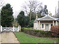
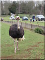
![Cotswold Wildlife Park [11] in OX18 4XD](https://images.propbar.co.uk/images/geograph/59/16/5916748_120.jpg)
46 photos from this area
Area Information
Key information about the OX18 4XD including its size, population, and administrative classification.
- Area Type
- Postcode
- Area Size
- 7503 m²
- Population
- 1131
- Population Density
- 36 people/km²
House Prices in OX18 4XD
8
Properties
£353,833
Average Sold Price
£185,000
Lowest Price
£436,000
Highest Price
Showing 8 properties
| Address | Type | Beds | Baths | Last Sale Price | Last Sale Date | |
|---|---|---|---|---|---|---|
| 1 Glissard Way, Bradwell Village, Burford, OX18 4XD | Detached | 4 | 2 | £415,000 | Oct 2023 | |
| 2 Glissard Way, Bradwell Village, Burford, OX18 4XD | Detached | 4 | 2 | £436,000 | Jun 2023 | |
| 5 Glissard Way, Bradwell Village, Burford, OX18 4XD | Detached | 3 | 2 | £415,000 | Sep 2022 | |
| 8 Glissard Way, Bradwell Village, Burford, OX18 4XD | Terraced | 2 | 2 | £320,000 | Dec 2021 | |
| 4 Glissard Way, Bradwell Village, Burford, OX18 4XD | house | 3 | 2 | £352,000 | Mar 2020 | |
| 6 Glissard Way, Bradwell Village, Burford, OX18 4XD | Terraced | 2 | 2 | £185,000 | Sep 2004 | |
| Honfleur, 3 Glissard Way, Bradwell Village, Burford, OX18 4XD | Detached | 3 | 2 | - | - | |
| 7 Glissard Way, Bradwell Village, Burford, OX18 4XD | house | - | - | - | - |
Energy Efficiency in OX18 4XD
Amenities
Schools
| Rank | School | Type | Entry gender | Ages |
|---|
Explore more schools in this area
Go to Schools tabDemographics
Household Size
Two person
most common
Accommodation Type
Houses
most common
Tenure
74
majority
Ethnic Group
White
most common
Religion
N/A
most common
Household Composition
N/A
most common
Age
47
median
Adults (30-64 years)
most common
Household Deprivation
N/A
with no deprivation
NS-SEC
45
in Lower managerial occupations
Explore more demographic insights in this area
Go to Demographics tabPlanning
Planning Constraints
- Flood RiskPremium
- Ramsar Wetland SitesPremium
- Area of Outstanding Natural BeautyPremium
- Protected Nature ReservePremium
- Protected WoodlandPremium