Area Overview for OX18 4SE
Photos of OX18 4SE
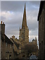
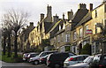

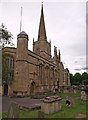

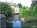
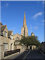
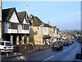
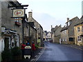
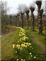
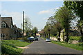
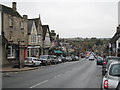
100 photos from this area
Area Information
Key information about the OX18 4SE including its size, population, and administrative classification.
- Area Type
- Postcode
- Area Size
- 5.5 hectares
- Population
- 1977
- Population Density
- 73 people/km²
House Prices in OX18 4SE
19
Properties
£366,183
Average Sold Price
£200,000
Lowest Price
£537,500
Highest Price
Showing 19 properties
| Address | Type | Beds | Baths | Last Sale Price | Last Sale Date | |
|---|---|---|---|---|---|---|
| Weavers Cottage, Guildenford, Burford, OX18 4SE | Terraced | 2 | 1 | £325,000 | Oct 2025 | |
| Tiverton Cottage, Guildenford, Burford, OX18 4SE | house | - | - | £365,784 | Jul 2021 | |
| 12 Guildenford, Burford, OX18 4SE | Bungalow | 2 | - | £410,000 | Jun 2019 | |
| Honeysuckle Cottage, 8 Guildenford, Burford, OX18 4SE | Semi-detached | - | - | £537,500 | Jun 2018 | |
| Emmanuel Cottage, 9 Guildenford, Burford, OX18 4SE | Cottage | 3 | - | £390,000 | Jun 2013 | |
| Homeleigh, 3 Guildenford, Burford, OX18 4SE | Terraced | - | - | £335,000 | Apr 2007 | |
| Forteys Close, Guildenford, Burford, OX18 4SE | Detached | 4 | 1 | £200,000 | Jan 1997 | |
| 1 Guildenford, Burford, OX18 4SE | Semi-detached | 3 | 2 | - | - | |
| 2 Guildenford, Burford, OX18 4SE | Terraced | 3 | - | - | - | |
| Public Conveniences, Guildenford, Burford, OX18 4SE | commercial | - | - | - | - |
Page 1 of 2
Energy Efficiency in OX18 4SE
Amenities
Schools
| Rank | School | Type | Entry gender | Ages |
|---|
Explore more schools in this area
Go to Schools tabDemographics
Household Size
Two person
most common
Accommodation Type
Houses
most common
Tenure
65
majority
Ethnic Group
White
most common
Religion
N/A
most common
Household Composition
N/A
most common
Age
47
median
Adults (30-64 years)
most common
Household Deprivation
N/A
with no deprivation
NS-SEC
41
in Lower managerial occupations
Explore more demographic insights in this area
Go to Demographics tabPlanning
Planning Constraints
- Flood RiskPremium
- Ramsar Wetland SitesPremium
- Area of Outstanding Natural BeautyPremium
- Protected Nature ReservePremium
- Protected WoodlandPremium