Area Overview for OX18 4AU
Photos of OX18 4AU


Area Information
Living in OX18 4AU means settling into a tightly knit residential cluster that defines the character of this part of England. This specific postcode covers a small population of 1,977 people, creating a quiet environment where neighbours know each other well. The area sits at a density of 73 people per square kilometre, ensuring there is ample space between homes while maintaining a strong sense of community. You will find that daily life here revolves around a need for practical commuting rather than urban convenience, as the local cluster prioritises a peaceful domestic setting. This location acts as a foothold for those seeking a home outside the immediate bustle of Oxford, offering a balance between isolation and connectivity. The residential nature of OX18 4AU makes it a distinct choice for buyers who value a low-traffic environment over proximity to a city centre. Every street corner reflects the intended purpose of this postcode, which remains firmly focused on housing. For residents, this translates to a lifestyle where the immediate surroundings are defined by domestic tranquility rather than commercial activity. The small population size means that local services tend to have a personal touch, catering specifically to the needs of this concentrated group of homeowners. When you look at the map of OX18 4AU, you see a chorus of houses designed for long-term living, away from the larger communal sprawls found elsewhere. This consistency in land use creates a predictable and stable environment, ideal for those planning to put down roots in a specific neighbourhood.
- Area Type
- Postcode
- Area Size
- Not available
- Population
- 1977
- Population Density
- 73 people/km²
The property market in OX18 4AU is characterised by a clear bias towards owner-occupied housing, with 65% of the area in private hands. This landscape is almost exclusively composed of houses, meaning that flats or purpose-built apartments are virtually non-existent in this postcode. Prospective buyers looking for homes here should expect traditional property types that suit long-term living rather than investment portfolios designed for short-term rental yields. The low rise in home ownership suggests that this is not a hotspot for buy-to-let landlords, but rather a place where people settle down. Each home in OX18 4AU is likely to have a garden, reflecting the preference for detached or semi-detached living over urban density. Because the accommodation type is strictly houses, the streetscapes will feature driveways, private yards, and a lower building height limit compared to city dwellings. Buying a home in this area guarantees you will see pitched roofs and brickwork rather than balconies or concrete facades. The market reflects the needs of the local demographic, providing space for families to expand and older residents to retain privacy. This consistency in housing stock makes it straightforward to understand the maintenance requirements and neighbourhood feel before viewing a single property. You will not encounter the variance in building quality or age that might appear in mixed-use developments elsewhere. Instead, every property aligns with the established character of the postcode, ensuring that new加入s blend seamlessly with existing homes.
House Prices in OX18 4AU
No properties found in this postcode.
Energy Efficiency in OX18 4AU
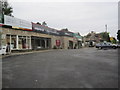
Residents of OX18 4AU enjoy practical access to essential amenities, including five retail outlets within easy reach. Co-op Burford, Co-op Centrum, and Co-op Brize serve as the primary shopping destinations, offering groceries and daily necessities you need. You will find that these Co-operative stores are spaced conveniently to reduce travel time for weekly shop runs. For aviation enthusiasts or those with scheduled travel, RAF Brize Norton is a notable airport located nearby. This facility provides local employment opportunities for residents living in the OX18 4AU postcode should they seek aviation-related careers. Public transport links are supported by two railway stations, specifically Shipton Railway Station and Ascott, which facilitate trips beyond the immediate rural setting. You can combine these rail links with the local retail options to create an efficient routine that balances work and leisure. The proximity to these specific venues means you do not need to drive far for everyday errands. Dining and leisure options are tied to the local village centres mentioned in the retail amenities, ensuring you have options for socialising without leaving the cluster. The layout of these amenities supports a lifestyle where you can manage your household needs efficiently while enjoying the peace of the countryside. Each store and station represents a node in the local network that keeps OX18 4AU connected to broader opportunities.
Amenities
Schools
Families living near OX18 4AU have access to a range of educational institutions, starting with Burford Primary School, which holds a Good Ofsted rating. You will also find Burford School and Community College nearby, offering primary education options for younger children. For secondary education, Burford School operates as an academy and carries a Good Ofsted rating, ensuring high standards for older students. The presence of multiple primary schools indicates that families can choose between different environments, potentially matching a child's learning style or specific educational needs. Having at least one academy in the immediate vicinity suggests that the education system here is adapting to modern pedagogical approaches while maintaining rigorous oversight. The concentration of schools named Burford implies a strong local network of educational services, all centred around the needs of the OX18 4AU population. Parents can expect these institutions to be well-resourced, given their positive performance ratings. The mix of statutory and academy-provided education offers flexibility, as you are not restricted to a single governing body for your child's schooling. When planning your move to OX18 4AU, consider the walking distance from the nearest school entrance, as this factor often influences property values within this cluster. The availability of both primary and secondary options on screen nearby reduces the need for long commutes to distant educational hubs.
| Rank | School | Type | Entry gender | Ages |
|---|
Explore more schools in this area
Go to Schools tabDemographics
The community within OX18 4AU is dominated by adults aged between 30 and 64 years, reflecting a mature household structure. With a median age of 47, this neighbourhood attracts families and established professionals who have moved past their early career stages. Home ownership stands at 65%, indicating that the majority of residents have purchased their properties rather than renting. This high level of tenure suggests stability within the homes of OX18 4AU, as most people intend to stay for the long term. Houses form the predominant accommodation type, shaping the visual landscape and neighbourly interactions across the postcode. The predominant ethnic group is White, mirroring the traditional demographic shifts seen in many rural and semi-rural parts of England. You will not find large numbers of single-person households or young children living alone in this area, as the age profile points towards couples or families with older children. The 65% home ownership rate is a significant figure that influences the local decision-making processes and community investment. Since most residents own their homes, changes to the local housing stock occur slowly and deliberately. This demographic reality creates an environment where neighbours share similar life stages and financial goals. The adult-centric population means that local events and community gatherings likely cater to a mature audience, focusing on family activities and practical matters rather than youth culture.
Household Size
Accommodation Type
Tenure
Ethnic Group
Religion
Household Composition
Age
Household Deprivation
NS-SEC
Explore more demographic insights in this area
Go to Demographics tabPlanning
Planning Constraints
- Flood RiskPremium
- Ramsar Wetland SitesPremium
- Area of Outstanding Natural BeautyPremium
- Protected Nature ReservePremium
- Protected WoodlandPremium