Area Overview for OX18 3ZQ
Photos of OX18 3ZQ


Area Information
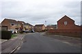
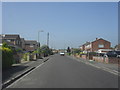
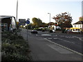
Postcode OX18 3ZQ defines a specific residential cluster within England, offering a quiet domestic setting for its residents. The area contains a population of 1,351 people, creating an intimate community where neighbours often interact regularly. This small footprint means services are readily accessible without lengthy commutes, yet the location retains the character of a distinct village rather than a sprawling suburb. Living in OX18 3ZQ provides a stable environment for families and individuals who prefer a slower pace of life away from major urban centres. The housing is centred around private dwellings, offering a sense of security and permanence that appeals to those seeking a traditional British neighbourhood. Daily life revolves around local routines, with access to key amenities situated within practical reach. The area functions as a self-contained hub, supporting independent living while maintaining proximity to wider regional opportunities. You will find that the rhythm of life here is dictated by local needs and community cohesion rather than fast-paced urban demands. This postcode serves as a stable home base, providing a backdrop of consistency for long-term residents who value their immediate surroundings.
- Area Type
- Postcode
- Area Size
- Not available
- Population
- 1351
- Population Density
- Not available
Propbar data indicates that the property market in OX18 3ZQ is driven by a strong preference for single-family dwellings. Houses are the main accommodation type available, which aligns with the needs of families and those seeking greater space than flats or apartments can provide. With 69% home ownership, the area is clearly an owner-occupied market rather than a high-rental neighbourhood. This dominance of homeownership suggests that sellers in this postcode often command higher prices to recoup investment costs and downsize. Buyers looking at homes in OX18 3ZQ should anticipate competition from move-up buyers who value ground-floor gardens, driveways, and the ease of converting garages. The small population of 1,351 means the total stock of available properties is limited, potentially driving up values for the few units that come onto the market. You will find that the housing stock caters to established households who have financed their purchases years ago. This contrasts sharply with regeneration zones or student cities where rental yields dominate the economic landscape of the housing sector.
House Prices in OX18 3ZQ
No properties found in this postcode.
Energy Efficiency in OX18 3ZQ
Your daily life in OX18 3ZQ benefits from the proximity of essential retail and transport hubs within practical reach. Five significant retail locations serve the immediate needs of the community, including Morrisons Carterton, Asda Carterton, and Aldi Carterton. Visiting these supermarkets means you do not need to travel far for groceries, household essentials, or prepared meals, saving you time on your weekly shopping trips. The area also offers easy access to RAF Brize Norton, the sole airport in the immediate vicinity. This transport link provides rapid connectivity for business travellers or those requiring air travel, integrating residential life with regional logistics. Shopping for fresh produce or larger household items becomes a short drive rather than a journey into a distant city centre. The concentration of major retailers like Asda and Aldi ensures that budget-friendly options remain accessible alongside quality produce sections. This amenity density creates a convenient lifestyle where work, leisure, and shopping can largely happen without leaving the local region. You can rely on these facilities to support all aspects of domestic life, from childcare supplies to personal holiday bookings.
Amenities
Schools
| Rank | School | Type | Entry gender | Ages |
|---|
Explore more schools in this area
Go to Schools tabDemographics
The community in OX18 3ZQ reflects a mature demographic profile, with a median age of 47 years. Adults aged between 30 and 64 years constitute the most common age range, indicating a settled population likely established in the area for an extended period. Home ownership stands at a high level, with 69% of the existing homes held by their occupants. This statistic confirms that the area is predominantly owner-occupied, filtering out many first-time buyers or international renters who might otherwise populate younger or more transient districts. Houses form the primary accommodation type, reinforcing the suburban nature of the settlement and limiting the presence of high-density housing blocks. The predominant ethnic group in this cluster is White, contributing to a culturally homogenous environment typical of many established English villages. You can expect a demographic stability where long-term residents make up the majority of the social fabric. These figures suggest a neighbourhood focused on family life and long-term stability rather than rapid demographic turnover. The high ownership rate also implies a market where selling can involve larger capital investments by current owners.
Household Size
Accommodation Type
Tenure
Ethnic Group
Religion
Household Composition
Age
Household Deprivation
NS-SEC
Explore more demographic insights in this area
Go to Demographics tabPlanning
Planning Constraints
- Flood RiskPremium
- Ramsar Wetland SitesPremium
- Area of Outstanding Natural BeautyPremium
- Protected Nature ReservePremium
- Protected WoodlandPremium
- Crime RiskPremium