Area Overview for OX18 3JE
Photos of OX18 3JE


Area Information
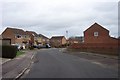
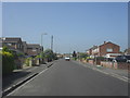
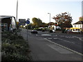
Living in OX18 3JE offers a quiet residential experience within a small cluster that accommodates 1,573 people. This postcode covers a specific area in England where daily life moves at a measured pace, defined more by convenience than urban density. You will find homes here in a setting that avoids major planning constraints, meaning you do not face restrictions from protected wetlands, areas of outstanding natural beauty, or designated nature reserves. The location is particularly practical for those who rely on their vehicle, given its proximity to RAF Brize Norton. While the immediate locality remains residential, the presence of large neighbouring retailers like Asda Carterton and Morrisons Daily ensures you have essential services nearby without needing to travel far. The area represents a straightforward choice for families or individuals seeking a private address with reliable access to transport infrastructure and essential goods. It is a place where you can build a life without the anxiety of environmental planning issues or significant safety risks.
- Area Type
- Postcode
- Area Size
- Not available
- Population
- 1573
- Population Density
- 3334 people/km²
The property market in OX18 3JE is distinctively characterised by a reliance on owned property rather than rentals or council housing. With 44 percent of residences owned by families or individuals, this area functions as a traditional family home market where families typically stay put. The stock consists entirely of houses, meaning there are no flats or apartments within this specific postcode cluster. When you look at homes in OX18 3JE, you are purchasing a standalone dwelling surrounded by similar residential structures. This consistency in property type simplifies the buying process for those specifically seeking a house in a rural or semi-rural setting. The high ownership rate suggests that properties here tend to appreciate through owner maintenance and improvement rather than developer-led regeneration. If you are looking for a rental investment in this small area, the options are limited by the fact that the majority of homes belong to the residents themselves. Buyers here often seek guaranteed quiet and garden space, which are premium features in the local market.
House Prices in OX18 3JE
No properties found in this postcode.
Energy Efficiency in OX18 3JE
Your lifestyle in OX18 3JE is defined by proximity to essential retail and strategic transport hubs within practical reach. Within walking or short driving distance, you have five major retail outlets, including Asda Carterton, Morrisons Daily, and Morrisons Carterton. These locations provide everything from groceries to household necessities without requiring a long car journey. Transport options include access to RAF Brize Norton, a significant airport nearby which may influence local noise levels or future transport developments. For those who drive, the speed and convenience of accessing these amenities make OX18 3JE a functional base for daily life. You will enjoy the ease of running errands in a matter of minutes rather than hours. The availability of large supermarket chains offers variety and value, while the airport proximity provides potential for business travel or flight options. This balance of retail convenience and transport infrastructure creates a practical living environment where you do not have to compromise on variety or accessibility.
Amenities
Schools
Families living in OX18 3JE benefit from immediate access to local education facilities, with one primary school located nearby. Gateway Primary School stands out as the nearest educational institution for younger children in the area. The school holds an Ofsted rating of good, which provides a solid foundation for your children's early education. You will not find secondary schools listed directly within the immediate vicinity of this postcode in the provided data, meaning families may need to commute or rely on catchment boundaries for older age groups. The presence of a well-rated primary school is a key factor for parents when choosing homes in OX18 3JE. It ensures that young children do not have to travel far to start their academic journey. While the data does not include other educational establishments, the standard provision suggests a functional local education network. When planning your move, you should verify the specific catchment area for Gateway Primary School to ensure eligibility for your future children.
| Rank | School | Type | Entry gender | Ages |
|---|---|---|---|---|
| 1 | Gateway Primary School | primary | N/A | N/A |
Explore more schools in this area
Go to Schools tabDemographics
The community in OX18 3JE reflects a settled population with a median age of 47 years. Most residents fall into the adult bracket between 30 and 64 years old, suggesting the area attracts mature households rather than students or empty-nesters seeking temporary accommodation forty-four percent of homes are owner-occupied, indicating a stable, long-term resident base. Accommodation types are exclusively houses, which aligns with the demographic preference for family living and larger private gardens. The predominant ethnic group is White, forming the cultural core of this neighbourhood. This age profile means you will find a community where children are often raised, followed by parents well into their productive working years. The data does not show high levels of transient moving, reinforcing the idea that once you move into OX18 3JE, you are likely to stay for the long term. This stability often translates into a more predictable local environment where neighbours know one another.
Household Size
Accommodation Type
Tenure
Ethnic Group
Religion
Household Composition
Age
Household Deprivation
NS-SEC
Explore more demographic insights in this area
Go to Demographics tabPlanning
Planning Constraints
- Flood RiskPremium
- Ramsar Wetland SitesPremium
- Area of Outstanding Natural BeautyPremium
- Protected Nature ReservePremium
- Protected WoodlandPremium
- Crime RiskPremium