Area Overview for OX18 2RG
Photos of OX18 2RG
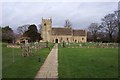
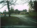
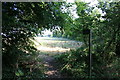
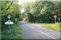

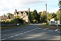
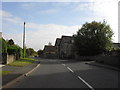
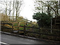
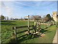
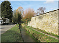


42 photos from this area
Area Information
Key information about the OX18 2RG including its size, population, and administrative classification.
- Area Type
- Postcode
- Area Size
- 45.5 hectares
- Population
- 2471
- Population Density
- 118 people/km²
House Prices in OX18 2RG
29
Properties
£783,676
Average Sold Price
£183,500
Lowest Price
£2,000,000
Highest Price
Showing 29 properties
| Address | Type | Beds | Baths | Last Sale Price | Last Sale Date | |
|---|---|---|---|---|---|---|
| Greenporch, Bampton Road, Clanfield, OX18 2RG | Detached | 4 | 3 | £840,000 | Mar 2025 | |
| Hurley House, Bampton Road, Clanfield, OX18 2RG | Semi-detached | 4 | 2 | £910,000 | Apr 2024 | |
| Culfre, Bampton Road, Clanfield, OX18 2RG | Detached | 5 | 4 | £2,000,000 | Sep 2023 | |
| Clanfelde Cottage, Bampton Road, Clanfield, OX18 2RG | Detached | - | - | £1,400,000 | Sep 2023 | |
| West Court, Bampton Road, Clanfield, OX18 2RG | house | - | - | £825,000 | Feb 2022 | |
| Tudor House, Bampton Road, Clanfield, OX18 2RG | Semi-detached | 5 | 3 | £970,000 | Sep 2018 | |
| Yew Tree Farm, Bampton Road, Clanfield, OX18 2RG | Detached | 4 | 3 | £720,000 | Jul 2015 | |
| Paddock Gate, Bampton Road, Clanfield, OX18 2RG | house | - | - | £410,000 | Jul 2015 | |
| Orchard House, Bampton Road, Clanfield, OX18 2RG | house | - | - | £400,000 | Apr 2012 | |
| Pond House, Bampton Road, Clanfield, OX18 2RG | house | 5 | - | £860,000 | Jan 2012 |
Page 1 of 3
Energy Efficiency in OX18 2RG
Amenities
Schools
| Rank | School | Type | Entry gender | Ages |
|---|
Explore more schools in this area
Go to Schools tabDemographics
Household Size
Two person
most common
Accommodation Type
Houses
most common
Tenure
65
majority
Ethnic Group
White
most common
Religion
N/A
most common
Household Composition
N/A
most common
Age
47
median
Adults (30-64 years)
most common
Household Deprivation
N/A
with no deprivation
NS-SEC
39
in Lower managerial occupations
Explore more demographic insights in this area
Go to Demographics tabPlanning
Planning Constraints
- Flood RiskPremium
- Ramsar Wetland SitesPremium
- Area of Outstanding Natural BeautyPremium
- Protected Nature ReservePremium
- Protected WoodlandPremium