Area Overview for OX18 1FQ
Photos of OX18 1FQ


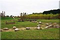


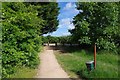
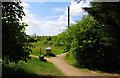
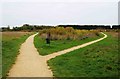

45 photos from this area
Area Information
Key information about the OX18 1FQ including its size, population, and administrative classification.
- Area Type
- Postcode
- Area Size
- 2882 m²
- Population
- 1365
- Population Density
- 6668 people/km²
House Prices in OX18 1FQ
13
Properties
£248,461
Average Sold Price
£172,000
Lowest Price
£320,000
Highest Price
Showing 13 properties
| Address | Type | Beds | Baths | Last Sale Price | Last Sale Date | |
|---|---|---|---|---|---|---|
| 15 Cedar Road, Carterton, OX18 1FQ | Detached | 2 | 1 | £275,000 | Oct 2025 | |
| 1 Cedar Road, Carterton, OX18 1FQ | Terraced | 4 | 1 | £310,000 | Aug 2023 | |
| 17 Cedar Road, Carterton, OX18 1FQ | Semi-detached | 3 | 2 | £320,000 | Dec 2021 | |
| 21 Cedar Road, Carterton, OX18 1FQ | Terraced | 2 | 1 | £225,000 | Dec 2019 | |
| 7 Cedar Road, Carterton, OX18 1FQ | Terraced | 3 | 2 | £267,500 | Nov 2019 | |
| 27 Cedar Road, Carterton, OX18 1FQ | Semi-detached | 3 | 2 | £267,000 | Aug 2018 | |
| 25 Cedar Road, Carterton, OX18 1FQ | Semi-detached | 3 | - | £280,000 | Aug 2018 | |
| 5 Cedar Road, Carterton, OX18 1FQ | Terraced | 3 | 3 | £262,000 | May 2018 | |
| 3 Cedar Road, Carterton, OX18 1FQ | Terraced | 3 | 1 | £260,000 | Mar 2018 | |
| 11 Cedar Road, Carterton, OX18 1FQ | Semi-detached | 2 | 1 | £235,000 | Jan 2018 |
Page 1 of 2
Energy Efficiency in OX18 1FQ
Amenities
Schools
| Rank | School | Type | Entry gender | Ages |
|---|
Explore more schools in this area
Go to Schools tabDemographics
Household Size
Family (3-5 people)
most common
Accommodation Type
Houses
most common
Tenure
61
majority
Ethnic Group
White
most common
Religion
N/A
most common
Household Composition
N/A
most common
Age
47
median
Adults (30-64 years)
most common
Household Deprivation
N/A
with no deprivation
NS-SEC
38
in Lower managerial occupations
Explore more demographic insights in this area
Go to Demographics tabPlanning
Planning Constraints
- Flood RiskPremium
- Ramsar Wetland SitesPremium
- Area of Outstanding Natural BeautyPremium
- Protected Nature ReservePremium
- Protected WoodlandPremium