Area Overview for OX17 3NF
Photos of OX17 3NF


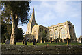
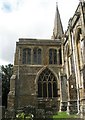


71 photos from this area
Area Information
Key information about the OX17 3NF including its size, population, and administrative classification.
- Area Type
- Postcode
- Area Size
- 3.7 hectares
- Population
- 1631
- Population Density
- 228 people/km²
House Prices in OX17 3NF
14
Properties
£392,750
Average Sold Price
£182,500
Lowest Price
£575,000
Highest Price
Showing 14 properties
| Address | Type | Beds | Baths | Last Sale Price | Last Sale Date | |
|---|---|---|---|---|---|---|
| Candlelight Cottage, 8 Oxford Road, Adderbury, OX17 3NF | Cottage | 2 | 1 | £370,000 | Dec 2024 | |
| Appletree Cottage, 7 Oxford Road, Adderbury, OX17 3NF | Semi-detached | 3 | 1 | £575,000 | Aug 2022 | |
| Grooms Lodge, Oxford Road, Adderbury, OX17 3NF | Detached | 3 | 2 | £495,000 | Feb 2022 | |
| White Lion Cottage, Oxford Road, Adderbury, OX17 3NF | house | 4 | - | £460,000 | Jun 2021 | |
| April Cottage, 5 Oxford Road, Adderbury, OX17 3NF | Semi-detached | 3 | 1 | £420,000 | Aug 2019 | |
| 12 Oxford Road, Adderbury, OX17 3NF | Detached | 2 | 1 | £200,000 | Jun 2014 | |
| 6 Oxford Road, Adderbury, OX17 3NF | house | - | - | £285,000 | Apr 2011 | |
| The Forge, 1 Oxford Road, Adderbury, OX17 3NF | Semi-detached | 4 | 3 | £480,000 | May 2008 | |
| Hill House, Oxford Road, Adderbury, OX17 3NF | Terraced | - | - | £460,000 | Oct 2002 | |
| Grasslands, 9 Oxford Road, Adderbury, OX17 3NF | Detached | 4 | 2 | £182,500 | Nov 1997 |
Page 1 of 2
Energy Efficiency in OX17 3NF
Amenities
Schools
| Rank | School | Type | Entry gender | Ages |
|---|
Explore more schools in this area
Go to Schools tabDemographics
Household Size
Two person
most common
Accommodation Type
Houses
most common
Tenure
80
majority
Ethnic Group
White
most common
Religion
N/A
most common
Household Composition
N/A
most common
Age
47
median
Adults (30-64 years)
most common
Household Deprivation
N/A
with no deprivation
NS-SEC
47
in Lower managerial occupations
Explore more demographic insights in this area
Go to Demographics tabPlanning
Planning Constraints
- Flood RiskPremium
- Ramsar Wetland SitesPremium
- Area of Outstanding Natural BeautyPremium
- Protected Nature ReservePremium
- Protected WoodlandPremium