Area Overview for OX17 3JJ
Photos of OX17 3JJ
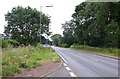
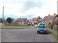
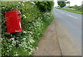
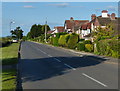
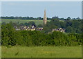
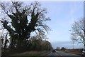

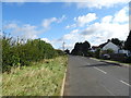
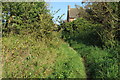
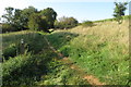
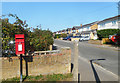
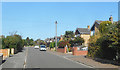
26 photos from this area
Area Information
Key information about the OX17 3JJ including its size, population, and administrative classification.
- Area Type
- Postcode
- Area Size
- 8882 m²
- Population
- 1859
- Population Density
- 203 people/km²
House Prices in OX17 3JJ
11
Properties
£504,286
Average Sold Price
£375,000
Lowest Price
£740,000
Highest Price
Showing 11 properties
| Address | Type | Beds | Baths | Last Sale Price | Last Sale Date | |
|---|---|---|---|---|---|---|
| 22 Twyford Gardens, Twyford, OX17 3JJ | Detached | 4 | 1 | £480,000 | Oct 2023 | |
| Carlyon House, 27 Twyford Gardens, Twyford, OX17 3JJ | Detached | 6 | 4 | £740,000 | Nov 2021 | |
| 21 Twyford Gardens, Twyford, OX17 3JJ | house | - | - | £590,000 | Mar 2021 | |
| 23A Twyford Gardens, Twyford, OX17 3JJ | Semi-detached | 4 | 2 | £415,000 | Dec 2019 | |
| Ewelm, 28A Twyford Gardens, Twyford, OX17 3JJ | house | 4 | - | £490,000 | Feb 2015 | |
| 29 Twyford Gardens, Twyford, OX17 3JJ | Detached | - | - | £375,000 | May 2007 | |
| Sundown House, Twyford Gardens, Twyford, OX17 3JJ | Detached | - | - | £440,000 | Jun 2006 | |
| Annexe Adjacent, Sundown House, 26 Twyford Gardens, Twyford, OX17 3JJ | Semi-detached | - | - | - | - | |
| St Clair, 28 Twyford Gardens, Twyford, OX17 3JJ | Detached | - | - | - | - | |
| The Firs, 24 Twyford Gardens, Twyford, OX17 3JJ | Detached | - | - | - | - |
Page 1 of 2
Energy Efficiency in OX17 3JJ
Amenities
Schools
| Rank | School | Type | Entry gender | Ages |
|---|
Explore more schools in this area
Go to Schools tabDemographics
Household Size
Family (3-5 people)
most common
Accommodation Type
Houses
most common
Tenure
77
majority
Ethnic Group
White
most common
Religion
N/A
most common
Household Composition
N/A
most common
Age
47
median
Adults (30-64 years)
most common
Household Deprivation
N/A
with no deprivation
NS-SEC
42
in Lower managerial occupations
Explore more demographic insights in this area
Go to Demographics tabPlanning
Planning Constraints
- Flood RiskPremium
- Ramsar Wetland SitesPremium
- Area of Outstanding Natural BeautyPremium
- Protected Nature ReservePremium
- Protected WoodlandPremium