Area Overview for OX16 9HS
Photos of OX16 9HS
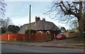
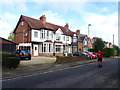
97 photos from this area
Area Information
Key information about the OX16 9HS including its size, population, and administrative classification.
- Area Type
- Postcode
- Area Size
- 1.7 hectares
- Population
- 1982
- Population Density
- 2426 people/km²
House Prices in OX16 9HS
21
Properties
£211,891
Average Sold Price
£127,500
Lowest Price
£310,000
Highest Price
Showing 21 properties
| Address | Type | Beds | Baths | Last Sale Price | Last Sale Date | |
|---|---|---|---|---|---|---|
| 27 Springfield Avenue, Banbury, OX16 9HS | house | - | - | £310,000 | Feb 2023 | |
| 3 Springfield Avenue, Banbury, OX16 9HS | Semi-detached | 3 | 1 | £305,000 | Dec 2022 | |
| 19 Springfield Avenue, Banbury, OX16 9HS | house | - | - | £270,000 | Sep 2021 | |
| 7 Springfield Avenue, Banbury, OX16 9HS | house | - | - | £167,525 | Jan 2014 | |
| 33 Springfield Avenue, Banbury, OX16 9HS | Semi-detached | 3 | - | £190,000 | May 2013 | |
| 25 Springfield Avenue, Banbury, OX16 9HS | house | - | - | £185,000 | Dec 2011 | |
| 13 Springfield Avenue, Banbury, OX16 9HS | house | - | - | £180,000 | Jun 2011 | |
| 5 Springfield Avenue, Banbury, OX16 9HS | Semi-detached | 3 | 1 | £171,997 | Jul 2004 | |
| 17 Springfield Avenue, Banbury, OX16 9HS | house | - | - | £127,500 | Apr 2001 | |
| 15 Springfield Avenue, Banbury, OX16 9HS | Semi-detached | - | - | - | - |
Page 1 of 3
Energy Efficiency in OX16 9HS
Amenities
Schools
| Rank | School | Type | Entry gender | Ages |
|---|
Explore more schools in this area
Go to Schools tabDemographics
Household Size
Family (3-5 people)
most common
Accommodation Type
Houses
most common
Tenure
71
majority
Ethnic Group
White
most common
Religion
N/A
most common
Household Composition
N/A
most common
Age
47
median
Adults (30-64 years)
most common
Household Deprivation
N/A
with no deprivation
NS-SEC
29
in Lower managerial occupations
Explore more demographic insights in this area
Go to Demographics tabPlanning
Planning Constraints
- Flood RiskPremium
- Ramsar Wetland SitesPremium
- Area of Outstanding Natural BeautyPremium
- Protected Nature ReservePremium
- Protected WoodlandPremium