Area Overview for OX16 8JX
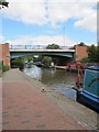
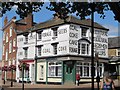
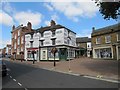
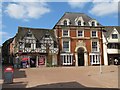
Photos of OX16 8JX


Area Information
Living in OX16 8JX means residing in a specific residential cluster that serves the wider Banbury region. This postcode covers a population of 2,073 people, creating an intimate setting where neighbours often know one another by name. While the area has limited administrative boundaries, its location near the town of Banbury provides essential access to services and employment opportunities without requiring a lengthy daily commute. Residents benefit from a mix of ground-floor and upper-level living options, with flats forming the predominant accommodation type in this zone. The demographic profile suggests a community dominated by adults aged between 30 and 64, indicating a steady population of professionals and families within working age. Daily life here is practical and straightforward, centred on local convenience and proximity to major transport hubs. There are no major planning constraints such as protected woodlands or wetlands affecting development, which simplifies potential local improvements. However, the character of OX16 8JX is defined more by its strategic position than by unique local landmarks. You will find that houses in OX16 8JX offer a quiet domestic atmosphere while maintaining close ties to the broader Banbury economy. High broadband scores ensure that digital isolation is not an issue for those working remotely.
- Area Type
- Postcode
- Area Size
- Not available
- Population
- 2073
- Population Density
- 4603 people/km²
Housing in OX16 8JX is characterised by a strong rental sector, as indicated by the fact that only 21% of residents own their homes. This percentage implies that nearly four out of every five households are renting, making this a area heavily geared towards tenants rather than owner-occupiers. Flats constitute the main type of accommodation, which fits the profile of a commuter belt location where budget-friendly or mid-range rentals are in high demand. Prospective homebuyers looking for houses in OX16 8JX may find limited stock compared to nearby zones dominated by detached or semi-detached properties. The dominance of rental properties suggests that value for money is a key driver for the majority of residents. You might find more competition in the rental market than in the sales market if you seek to purchase somewhere in this immediate vicinity. The small size of the postcode area, housing just 2,073 people, means that available properties can move quickly once listed. Buyers must act swiftly if they wish to secure a flat or house within this compact zone. While the lack of owner-occupiers might deter some investors seeking long-term stability, it offers flexibility for those willing to navigate the local tenancy landscape.
House Prices in OX16 8JX
No properties found in this postcode.
Energy Efficiency in OX16 8JX
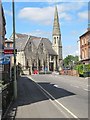
Daily life for residents of OX16 8JX revolves around proximity to Banbury, offering a convenient range of shops and transport hubs. Ten retail venues are within easy reach, providing ample choice for grocery shopping and daily necessities. You will find major supermarkets such as Tesco High, Iceland Banbury, and Farmfoods Banbury nearby, ensuring that food shopping is never a distance away. For commuters, the area is well-served by rail, with Banbury Railway Station and Kings Sutton Railway Station acting as primary gateways to the wider network. These stations offer frequent services, making travel to London or Oxford straightforward. The absence of local leisure facilities or parks in the specific data suggests that social activities often centre on the Banbury town centre rather than within the postcode itself. Retail density provides a practical lifestyle, allowing you to run errands quickly without significant travel time. While the immediate surroundings lack extensive green spaces or entertainment venues listed in the data, the transport links compensate by granting instant access to broader cultural offerings in Banbury. Living in OX16 8JX offers a functional lifestyle anchored by retail convenience and reliable rail access.
Amenities
Schools
Families living in OX16 8JX have access to a small but distinct selection of educational institutions within practical reach. Dashwood School stands as the nearest primary establishment for younger children. For parents seeking an alternative education pathway, St John's Priory School is available as an independent option. This latter institution holds a 'good' Ofsted rating, providing a tangible quality marker for families making decisions about their children's upbringing. English Language Training is also present in the immediate vicinity, catering to adult learners and enhancing the area's support services for non-native speakers. The presence of an independent school alongside state provision indicates a degree of educational choice for residents. There is only one primary school listed for this postcode, which may limit options for those requiring specific specialisms or religious education found in larger comprehensive clusters. While the data does not provide staff-to-pupil ratios or exam results, the named schools offer established environments for student development. Parents looking at schools near OX16 8JX will find a mix of state and independent provision that serves the needs of the predominantly adult community.
| Rank | School | Type | Entry gender | Ages |
|---|
Explore more schools in this area
Go to Schools tabDemographics
The community in OX16 8JX is defined by a mature demographic structure centred on adults aged between 30 and 64 years. This specific age range represents the most common group of residents, suggesting a neighbourhood that attracts established professionals rather than young families or retirees. The median age for the population is 47 years, reinforcing the idea that this is a stable, mid-career community. Tenure patterns show a significant divergence from traditional suburban districts, with only 21% of homes occupied by their owners. This low ownership rate indicates that the majority of households in this postcode consist of private tenants rather than owner-occupiers. Flats are the primary form of accommodation, aligning with the high proportion of rented stock. The population is predominantly white, reflecting the broader statistical trends of the United Kingdom without notable ethnic variations specific to this small cluster. Because the area consists mainly of rented flats, you are likely to encounter a transient element of the population, although the age profile suggests long-term tenancies for many. There is no data on deprivation levels for this specific postcode, so quality of life must be assessed through other metrics such as transport links and school access. The mix of renters and steady adults creates a dynamic but distinct social environment compared to owner-occupied estates.
Household Size
Accommodation Type
Tenure
Ethnic Group
Religion
Household Composition
Age
Household Deprivation
NS-SEC
Explore more demographic insights in this area
Go to Demographics tabPlanning
Planning Constraints
- Flood RiskPremium
- Ramsar Wetland SitesPremium
- Area of Outstanding Natural BeautyPremium
- Protected Nature ReservePremium
- Protected WoodlandPremium