Area Overview for OX16 5EY
Photos of OX16 5EY


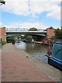
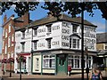
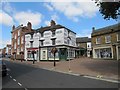
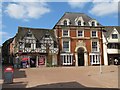


100 photos from this area
Area Information
Key information about the OX16 5EY including its size, population, and administrative classification.
- Area Type
- Postcode
- Area Size
- Not available
- Population
- 1512
- Population Density
- 4044 people/km²
House Prices in OX16 5EY
41
Properties
£104,190
Average Sold Price
£54,950
Lowest Price
£160,000
Highest Price
Showing 41 properties
| Address | Type | Beds | Baths | Last Sale Price | Last Sale Date | |
|---|---|---|---|---|---|---|
| 10, Spencer Court, Britannia Road, Banbury, OX16 5EY | Flat | - | - | £85,000 | May 2025 | |
| 26, Spencer Court, Britannia Road, Banbury, OX16 5EY | Flat | 2 | 1 | £78,000 | Apr 2025 | |
| 16, Spencer Court, Britannia Road, Banbury, OX16 5EY | Flat | - | - | £70,000 | Sep 2024 | |
| 39, Spencer Court, Britannia Road, Banbury, OX16 5EY | Flat | - | - | £77,500 | Aug 2023 | |
| 9, Spencer Court, Britannia Road, Banbury, OX16 5EY | Flat | - | - | £115,000 | Nov 2022 | |
| 34, Spencer Court, Britannia Road, Banbury, OX16 5EY | Flat | 1 | 1 | £110,000 | Sep 2022 | |
| 7, Spencer Court, Britannia Road, Banbury, OX16 5EY | Flat | - | - | £123,000 | Sep 2022 | |
| 14, Spencer Court, Britannia Road, Banbury, OX16 5EY | Flat | 1 | 1 | £98,000 | May 2022 | |
| 19, Spencer Court, Britannia Road, Banbury, OX16 5EY | Flat | 2 | 1 | £135,000 | Jan 2022 | |
| 5, Spencer Court, Britannia Road, Banbury, OX16 5EY | Flat | 2 | 1 | £150,000 | May 2021 |
Page 1 of 5
Energy Efficiency in OX16 5EY
Amenities
Schools
| Rank | School | Type | Entry gender | Ages |
|---|
Explore more schools in this area
Go to Schools tabDemographics
Household Size
One person
most common
Accommodation Type
Flats
most common
Tenure
30
majority
Ethnic Group
White
most common
Religion
N/A
most common
Household Composition
N/A
most common
Age
47
median
Adults (30-64 years)
most common
Household Deprivation
N/A
with no deprivation
NS-SEC
30
in Lower managerial occupations
Explore more demographic insights in this area
Go to Demographics tabPlanning
Planning Constraints
- Flood RiskPremium
- Ramsar Wetland SitesPremium
- Area of Outstanding Natural BeautyPremium
- Protected Nature ReservePremium
- Protected WoodlandPremium