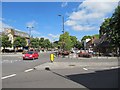
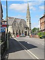
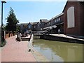
Area Overview for OX16 5AH
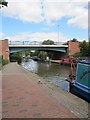
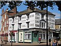
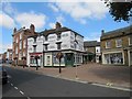
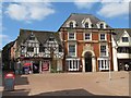
Photos of OX16 5AH


Area Information
Living in OX16 5AH means residing within a very specific residential cluster driven by Banbury's suburbia. You are situated in an area that spans exactly 1276 square metres, a footprint that is unusually compact compared to broader postal sectors. This small scale reflects a cluster of flats and houses designed for urban convenience rather than sprawling expansion. You find a population of 2073 people packed into this confined space, resulting in a population density that reaches 1,625,072 people per square kilometre. This high density creates an immediate sense of proximity; neighbours are close, noise travels easily, and local roads fill up during peak hours. The area does not offer the isolation of rural life, nor does it stretch into the vast districts found in outer suburbs. Instead, you experience a concentrated living environment where resources are accessible across short distances. Daily life revolves around immediate amenities, with shops and transport hubs just steps away. The character of OX16 5AH is defined by its function as a dense residential node within the wider Oxfordshire landscape. You are part of a community that prioritises access over spaciousness, catering to individuals who value being central to daily activities. The area sits between Banbury Railway Station and Kings Sutton Railway Station, within practical reach of both. This location places you at the heart of the commuter network without requiring a journey to find your nearest convenience. Understanding that this is a postcode area covering a small residential cluster helps you manage expectations regarding property values and future development. The layout is fixed and known, removing the uncertainty of which directions lead where.
- Area Type
- Postcode
- Area Size
- 1276 m²
- Population
- 2073
- Population Density
- 4603 people/km²
The property market in OX16 5AH is defined by its accommodation type, which consists almost entirely of flats. This housing stock contrasts sharply with areas dominated by detached houses or semi-detached bungalows. With only 21% of residents owning their homes, the area operates heavily on a rental basis. You are looking at a market where landlords and housing associations likely hold the keys to most residences. This dynamic influences the types of deals available; tenants often seek security and value, while owners appreciate the density and low maintenance costs of flat living. The market does not cater to the buyer seeking a large garden or detached status, but rather appeals to those prioritising proximity and convenience. For buyers entering this market, the high proportion of flats means you must consider shared ownership structures, leasehold terms, and local rental yields. The area's small size, covering merely 1276 square metres, limits the variety of street plans and building styles you might encounter. You will find that properties are clustered tightly together, creating a built-up streetscape rather than a spread-out neighbourhood. The fact that so many residents rent suggests a flexibility in tenancy that characterises the daily rhythm of life here. When evaluating properties, you should inspect for amenities within the block itself, as external spaces are often limited by the high population density. Understanding that this is a rental-heavy environment prepares you for specific considerations regarding service charges, building insurance, and management companies. The market reality is straightforward: you are buying or renting in a high-density flat zone focused on urban living rather than garden relaxation.
House Prices in OX16 5AH
Showing 4 properties
| Address | Type | Beds | Baths | Last Sale Price | Last Sale Date | |
|---|---|---|---|---|---|---|
| 4, Jervis Terrace, St Johns Road, Banbury, OX16 5AH | Terraced | 2 | 1 | - | - | |
| 1, Jervis Terrace, St Johns Road, Banbury, OX16 5AH | Terraced | 2 | 1 | - | - | |
| 3, Jervis Terrace, St Johns Road, Banbury, OX16 5AH | house | - | - | - | - | |
| 2, Jervis Terrace, St Johns Road, Banbury, OX16 5AH | house | - | - | - | - |
Energy Efficiency in OX16 5AH
The lifestyle in OX16 5AH revolves around immediate access to essential services and shopping options. Within practical reach, you find five notable retail outlets including Farmfoods Banbury, Iceland Banbury, and Morrisons Daily Banbury. These chains ensure you can stock up on groceries and fresh food without leaving the area. You benefit from a range of supermarket options, allowing you to choose between different price points and product ranges based on your needs. For travelling further, two rail stations serve the community: Banbury Railway Station and Kings Sutton Railway Station. These transport hubs connect you to broader regional networks efficiently. Your days will likely involve quick trips to the local farm stores and major supermarkets for shopping errands. The proximity of these retail giants reduces the need for long drives or complex public transport journeys. Dining, hard-line shopping, and general household needs are all within a short walk or drive. The character of this lifestyle is one of practical convenience. You live close to the commercial activities that sustain daily life, avoiding the isolation of remote pockets. The area supports a routine where errands take little time. This setup fits well with a busy schedule, offering the security of knowing essentials are just around the corner. The retail density complements the residential population of 2073, creating a self-contained environment for basic needs.
Amenities
Schools
Families living in or near OX16 5AH have access to a specific set of educational institutions within practical reach. Dashwood School serves the local primary education needs for younger children in the community. For independent schooling options, St John's Priory School stands out with a 'good' Ofsted rating, offering a private alternative for families seeking that particular educational model. Additionally, English Language Training is available in the vicinity, catering to non-native speakers or those requiring specific language instruction. This mix provides choices for different academic paths and language requirements. The presence of St John's Priory School adds a layer of prestige to the local educational landscape, even though private schools cater to a smaller subset of the student population. Your children benefit from access to both mainstream primary education through Dashwood School and specialist independent education nearby. The availability of English Language Training suggests the area accommodates mobile professionals or expatriates who may need formal language support. You do not find a broad spectrum of mixed schools listed in the immediate data, but the options present a functional selection for families prioritising either independent education or language development. This specific list of schools shapes the school run and determines which catchment areas work for your daily schedule.
| Rank | School | Type | Entry gender | Ages |
|---|
Explore more schools in this area
Go to Schools tabDemographics
The community in OX16 5AH is distinctly mature, with a median age of 47 years. Most residents fall into the adult age range between 30 and 64 years, suggesting a household demographic focused on mid-life stability and career establishment rather than young families just starting out. You are dealing with a population that has settled into their routines and taken on significant responsibilities. Home ownership stands at just 21%, which indicates that the vast majority of you are private tenants or live in rental accommodation. This low ownership figure is typical for areas dominated by housing providers and large-scale tenancies rather than owner-occupied bungalows or detached homes. The predominant ethnic group in OX16 5AH is White, reflecting the broader demographic trends found in many established commuter towns across England. You are part of a diverse yet largely traditional community structure. The accommodation type consists primarily of flats, which aligns perfectly with the high population density and the lower rate of home ownership. This composition often appeals to professionals looking for secure rentals near work or for families needing an efficient home management solution. The sheer number of people per unit, combined with the adult-heavy age profile, shapes the social rhythm of the streets. You will encounter neighbours who have been in their properties for years, fostering a sense of established community ties. The environment suits those who prefer a suburban or townhouse feel within a compact, well-defined postal sector.
Household Size
Accommodation Type
Tenure
Ethnic Group
Religion
Household Composition
Age
Household Deprivation
NS-SEC
Explore more demographic insights in this area
Go to Demographics tabPlanning
Planning Constraints
- Flood RiskPremium
- Ramsar Wetland SitesPremium
- Area of Outstanding Natural BeautyPremium
- Protected Nature ReservePremium
- Protected WoodlandPremium