Area Overview for OX16 3TY
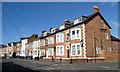
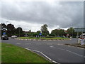
Photos of OX16 3TY


Area Information
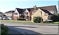
OX16 3TY is a small residential cluster covering 9327 square metres with a population of 1664. This postcode area represents a compact neighbourhood where daily life revolves around close proximity to essential local services. Residents enjoy a dense living environment characterised by a population density of 178,413 people per square kilometre. While the area size is modest, the community offers a tight-knit atmosphere typical of suburban clusters near larger towns. The location provides immediate access to key transport links and retail outlets without the need to travel far beyond the boundary lines of the cluster. You will find that houses dominate the streetscape rather than high-rise blocks or mixed-use developments. The area sits within the broader Banbury hinterland, offering a balance between quiet domestic living and convenient access to town centres. Prospective buyers looking for a defined residential zone with established boundaries should consider this specific postcode as a self-contained unit. The scale of the area suggests a managed community feel rather than the sprawling anonymity of larger urban districts. Every address here is within a short walking distance of the designated amenities listed for the zone.
- Area Type
- Postcode
- Area Size
- 9327 m²
- Population
- 1664
- Population Density
- 2527 people/km²
The property market in OX16 3TY is characterised by a significant portion of owner-occupied homes with a home ownership level of 48 per cent. This figure indicates that the area comprises a healthy mix of owner-occupiers and renters, though nearly half of the population has purchased their residence. Houses remain the primary form of accommodation, suggesting a neighbourhood built for standalone dwellings rather than flats or purpose-built rentals. Buyers examining this small residential cluster will find a stock aligned with traditional suburban housing preferences. The 48 per cent ownership rate suggests that the area appeals to those seeking stability and the security of freehold or leasehold ownership. For investors, the mix of ownership types provides opportunities for both buy-to-let properties and resale potential within a stable environment. The prevalence of houses offers more space and privacy compared to flat-heavy developments found in other parts of Oxfordshire. Families moving into this postcode benefit from housing types designed for gardens and private outdoor areas. The market dynamics here reflect a cautious but steady demand for established residential property rather than speculative new builds.
House Prices in OX16 3TY
Showing 20 properties
| Address | Type | Beds | Baths | Last Sale Price | Last Sale Date | |
|---|---|---|---|---|---|---|
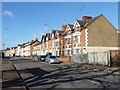
| 167 West Street, Banbury, OX16 3TY | house | 3 | 2 | £299,999 | Apr 2022 | |
| 175 West Street, Banbury, OX16 3TY | Semi-detached | 2 | - | £248,000 | Jan 2022 | |
| 189 West Street, Banbury, OX16 3TY | Bungalow | - | - | £180,000 | Sep 2021 | |
| 177 West Street, Banbury, OX16 3TY | Semi-detached | 3 | 1 | £192,000 | Oct 2019 | |
| 171 West Street, Banbury, OX16 3TY | house | - | - | £205,000 | Apr 2017 | |
| 173 West Street, Banbury, OX16 3TY | Bungalow | 3 | - | £212,000 | Jan 2017 | |
| 187 West Street, Banbury, OX16 3TY | Terraced | 3 | 1 | £175,000 | Dec 2016 | |
| 199 West Street, Banbury, OX16 3TY | Terraced | 1 | 1 | £133,000 | Jul 2015 | |
| 193 West Street, Banbury, OX16 3TY | Terraced | 1 | - | £119,000 | Jul 2013 | |
| 203 West Street, Banbury, OX16 3TY | Terraced | - | - | £87,500 | Sep 2003 |
Energy Efficiency in OX16 3TY
Your daily life in OX16 3TY includes convenient access to five retail outlets within practical reach. You can choose between Tesco Middleton, Co-op Burchester, and Lidl Spiceball for your weekly grocery shopping and everyday essentials. These three named supermarkets provide a range of price points and product lines to suit different household budgets. The presence of these specific retailers ensures that you rarely need to travel far for basic goods. Two railway stations serve the local community: Banbury Railway Station and Kings Sutton Railway Station. Access to these railheads simplifies commutes to Oxford, London, and other regional employers without requiring a car for daily travel. The area offers a balanced lifestyle combining quiet residential streets with immediate commercial convenience. Walking from your home allows direct access to major supermarkets without navigating complex road networks. This layout caters particularly well to families with children or residents who prefer walking over driving for short trips. The retail options represent a complete circle of daily needs from fresh produce to household cleaning supplies.
Amenities
Schools
Families living in OX16 3TY benefit from access to two primary educational institutions nearby. St Mary's Church of England (VC) Primary School, Banbury serves as a local option for younger children in the community. Residents also have the choice of St Mary's Church of England Primary School, Banbury, which holds a good Ofsted rating. This designation confirms that the school meets the required standards for education quality and student well-being. Both schools are of the Church of England type, featuring religious education as a central part of the curriculum. The presence of two primary options gives parents flexibility when selecting the right fit for their children. Neither institution is listed as secondary, so older students in the 30-64 age bracket likely attended schools in the wider Banbury area or beyond. The good rating of one of the primary schools adds a point of distinction for families prioritising educational quality in their home search. School catchment areas may extend beyond the immediate cluster, but these two names appear as the nearest listed facilities. Choosing a home in this postcode grants your children reasonable walking or biking distance to these established institutions.
| Rank | School | Type | Entry gender | Ages |
|---|
Explore more schools in this area
Go to Schools tabDemographics
The community in OX16 3TY is defined by a mature demographic with a median age of 47. The most common age range for residents is adults between 30 and 64 years, indicating a population that has likely settled into family life or semi-retirement. Home ownership stands at 48 per cent, meaning nearly half of the households have purchased their properties outright. This ownership rate reflects a stable community where many residents have established long-term roots in the postcode. Houses form the predominant accommodation type across the cluster, aligning with the needs of families and older adults seeking private space. The predominant ethnic group in the area is White, consistent with the broader Banbury demographic profile. With a population of 1664, the area maintains a relatable scale where neighbours often know one another by name. The age profile suggests fewer young children living alone compared to villages with a lower median age, yet the presence of the 30-64 age group ensures active community participation. This demographic structure supports local shops and services targeting established households rather than young professionals or students.
Household Size
Accommodation Type
Tenure
Ethnic Group
Religion
Household Composition
Age
Household Deprivation
NS-SEC
Explore more demographic insights in this area
Go to Demographics tabPlanning
Planning Constraints
- Flood RiskPremium
- Ramsar Wetland SitesPremium
- Area of Outstanding Natural BeautyPremium
- Protected Nature ReservePremium
- Protected WoodlandPremium