Area Overview for OX16 1QH
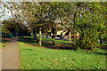
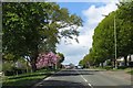
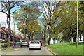
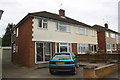
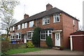
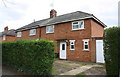
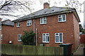
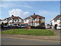
Photos of OX16 1QH
Area Information
OX16 1QH represents a very small residential cluster in England, covering an area of 4308 square metres. This tiny footprint accommodates a population of 1479 people, creating one of the most densely settled neighbourhoods in the country with a density of 343287 people per square kilometre. Living in this postcode means you reside in a tightly knit cluster where every street is within easy walking distance of others. The area is defined by its compact nature rather than sprawling development. You are part of a community where residents live close together, resulting in high interaction potential. This density supports a distinct local character, separate from larger expansions or isolated developments. The sheer concentration of homes in such a limited space defines the daily rhythm for anyone choosing to buy or rent here.
- Area Type
- Postcode
- Area Size
- 4308 m²
- Population
- 1479
- Population Density
- 2285 people/km²
Homes in OX16 1QH are primarily occupied by owner-occupiers, with 56 per cent of residents owning their properties outright or with a mortgage. This majority ownership profile indicates a market driven by long-term residency rather than transient renting. Houses make up the bulk of the housing stock, suggesting a focus on detached, semi-detached, or terraced properties rather than blocks of flats. The small area size of 4308 square metres dictates a high density of homes, meaning supply in the immediate vicinity is extremely limited. Buyers looking at this specific postcode should expect competition for available stock due to the scarcity of listings within the cluster. The concentration of houses supports a stable market where families have established roots. Opportunities to buy are likely rare, and interest will remain high from those specifically seeking this precise location.
House Prices in OX16 1QH
Showing 16 properties
| Address | Type | Beds | Baths | Last Sale Price | Last Sale Date | |
|---|---|---|---|---|---|---|
| 40 Portway, Banbury, OX16 1QH | Terraced | 2 | 1 | £264,000 | Dec 2025 | |
| 38 Portway, Banbury, OX16 1QH | Terraced | 3 | 1 | £279,000 | Aug 2024 | |
| 36 Portway, Banbury, OX16 1QH | Terraced | 2 | 1 | £190,000 | May 2023 | |
| 44 Portway, Banbury, OX16 1QH | house | - | - | £200,000 | Jun 2021 | |
| 41 Portway, Banbury, OX16 1QH | Terraced | 2 | 1 | £210,000 | Jul 2019 | |
| 39 Portway, Banbury, OX16 1QH | house | 2 | - | £174,950 | Aug 2015 | |
| 31 Portway, Banbury, OX16 1QH | house | - | - | £127,000 | Dec 2004 | |
| 35 Portway, Banbury, OX16 1QH | Terraced | - | - | £37,700 | Jan 2002 | |
| 45 Portway, Banbury, OX16 1QH | Terraced | 2 | - | £52,950 | Sep 1998 | |
| 34 Portway, Banbury, OX16 1QH | house | - | - | - | - |
Energy Efficiency in OX16 1QH
Daily life in OX16 1QH connects you to specific retail and transport hubs within practical reach. Residents can easily access popular supermarkets including Co-op Ruscote, Co-op Hardwick, and Aldi Ruscote for all shopping needs. For travel, the area offers access to Banbury Railway Station and Kings Sutton Railway Station, providing essential links for commuters leaving the cluster. You do not need to travel far to secure groceries or daily essentials, as these five nearby shops serve the immediate population. The presence of two railway stations ensures that leaving the area for employment or leisure is straightforward. This combination of local retail and rail connectivity means you can balance quiet home life with efficient access to wider towns.
Amenities
Schools
| Rank | School | Type | Entry gender | Ages |
|---|
Explore more schools in this area
Go to Schools tabDemographics
The community in OX16 1QH is dominated by adults aged between 30 and 64 years, reflecting a working-age population. The median age sits at 47, indicating older adults form a significant portion of the demographic profile. More than half of the residents, at 56 per cent, own their homes. This high ownership rate suggests financial stability among families and individuals living in the area. Houses are the predominant form of accommodation, meaning terraced flats or British apartments are rare in this cluster. The population is predominantly White, mirroring the broader ethnic composition of many traditional English suburbs. With a population of nearly 1500 people concentrated in such a small area, you will encounter a familiar community atmosphere without the anonymity of cities.
Household Size
Accommodation Type
Tenure
Ethnic Group
Religion
Household Composition
Age
Household Deprivation
NS-SEC
Explore more demographic insights in this area
Go to Demographics tabPlanning
Planning Constraints
- Flood RiskPremium
- Ramsar Wetland SitesPremium
- Area of Outstanding Natural BeautyPremium
- Protected Nature ReservePremium
- Protected WoodlandPremium