Area Overview for OX16 1DE
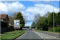
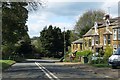
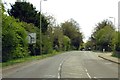
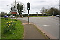
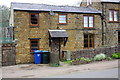
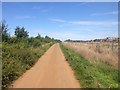
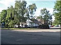
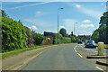
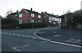
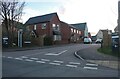
Photos of OX16 1DE

Area Information
Living in OX16 1DE means choosing a small, defined residential cluster with precise boundaries. This specific postcode covers an area of just 2,266 square metres, creating a tightly knit environment for its 1,414 residents. The density here is significant, with 624,061 people per square kilometre, indicating a compact living situation typical of established settlements. Daily life in OX16 1DE is characterised by proximity and a strong sense of place. You will find yourself close to essential services without the sprawling chaos of larger urban centres. The area functions as a quiet residential node where neighbours know one another. It is a location defined by its focus on housing rather than commercial activity. For those seeking a home in this rural-urban fringe, the setting offers a distinct break from the city while maintaining necessary links to wider transport networks. The environment is practical and straightforward, prioritising the needs of those who have built a life within this specific geographic footprint.
- Area Type
- Postcode
- Area Size
- 2266 m²
- Population
- 1414
- Population Density
- 4447 people/km²
The property market in OX16 1DE is dominated by houses, with 80% of the area accounted for by owner-occupied properties. This high percentage of homeownership suggests that the housing stock consists largely of detached or semi-detached homes held by long-term residents. You will find few rental units, which indicates a stable environment where people buy to stay. This profile often appeals to buyers looking for a permanent home rather than a temporary step in their portfolio. The accommodation type is exclusively houses, meaning you will not find flats or maisonettes in this specific postcode. This is consistent with the adult demographic and the local preference for garden space and family-sized living. For those searching for homes in OX16 1DE, the market offers traditional property types suited to a mature household. The dominance of owner-occupiers means that turnover may be slower, and prices may reflect the value placed on stability.
House Prices in OX16 1DE
Showing 9 properties
| Address | Type | Beds | Baths | Last Sale Price | Last Sale Date | |
|---|---|---|---|---|---|---|
| 31 Morris Drive, Banbury, OX16 1DE | house | - | - | £300,000 | Apr 2024 | |
| 41 Morris Drive, Banbury, OX16 1DE | Semi-detached | 3 | 1 | £256,000 | Sep 2021 | |
| 33 Morris Drive, Banbury, OX16 1DE | house | - | - | £256,129 | Jan 2016 | |
| 39 Morris Drive, Banbury, OX16 1DE | house | - | - | £157,000 | Aug 2004 | |
| 47 Morris Drive, Banbury, OX16 1DE | Semi-detached | - | - | £157,000 | Jul 2004 | |
| 43 Morris Drive, Banbury, OX16 1DE | Semi-detached | - | - | £130,000 | Jun 2004 | |
| 35 Morris Drive, Banbury, OX16 1DE | Semi-detached | - | - | £157,500 | Jan 2004 | |
| 37 Morris Drive, Banbury, OX16 1DE | house | - | - | £89,000 | Jan 2001 | |
| 45 Morris Drive, Banbury, OX16 1DE | house | - | - | - | - |
Energy Efficiency in OX16 1DE
Local amenities form the backbone of daily life for residents of OX16 1DE. Within practical reach, you have access to five retail outlets. Notable name such as Co-op Hardwick, Co-op Ruscote, and Aldi Ruscote provide essential shopping needs. Having multiple Co-operatives and a major supermarket nearby ensures you can run errands conveniently without travelling far. Additionally, two railway stations lie close by, namely Banbury Railway Station and Kings Sutton Railway Station. These transport hubs offer rail links for commuting to larger employment centres. Access to these stations means you have flexibility for travel if you work outside the immediate locality. The combination of immediate retail and nearby rail transport creates a balanced lifestyle where convenience meets connectivity.
Amenities
Schools
Families living in OX16 1DE benefit from access to Hill View Primary School. This institution serves as a local educational centre for younger children in the vicinity. The school holds a 'good' Ofsted rating, confirming its quality of education and care for pupils. As a primary school, it caters specifically to children in the early stages of their academic journey. There are no secondary schools listed in the immediate data for this location, meaning families may need to look slightly further afield for comprehensive education. The presence of Hill View Primary School provides a reliable foundation for early learning. For those evaluating schools near OX16 1DE, this facility stands out as the key option for primary education. A good rating offers peace of mind regarding the standard of instruction your children will receive.
| Rank | School | Type | Entry gender | Ages |
|---|
Explore more schools in this area
Go to Schools tabDemographics
The community in OX16 1DE reflects a mature population with a median age of 47 years. Most residents fall within the adult range of 30 to 64 years, suggesting a stable demographic profile where families and professionals have settled long term. Home ownership stands at an impressive 80%, marking this as a predominantly owner-occupied area rather than a rental market. This high level of ownership typically correlates with stability and long-term investment in the property. The primary accommodation type consists of houses, which aligns with the preference of this age group for space and traditional living arrangements. The population is predominantly White, matching the broader national trend for this region. These statistics paint a picture of a quiet, established neighbourhood where residents are likely to stay put. The high rate of homeownership means you are less likely to encounter transient populations. When considering homes in OX16 1DE, you are looking into settlements where inhabitants have deep roots in the community.
Household Size
Accommodation Type
Tenure
Ethnic Group
Religion
Household Composition
Age
Household Deprivation
NS-SEC
Explore more demographic insights in this area
Go to Demographics tabPlanning
Planning Constraints
- Flood RiskPremium
- Ramsar Wetland SitesPremium
- Area of Outstanding Natural BeautyPremium
- Protected Nature ReservePremium
- Protected WoodlandPremium