Area Overview for OX16 0UY
Photos of OX16 0UY

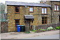
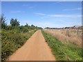
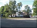
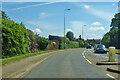
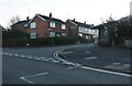
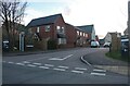
24 photos from this area
Area Information
Key information about the OX16 0UY including its size, population, and administrative classification.
- Area Type
- Postcode
- Area Size
- 8558 m²
- Population
- 1291
- Population Density
- 4760 people/km²
House Prices in OX16 0UY
30
Properties
£141,234
Average Sold Price
£37,500
Lowest Price
£280,000
Highest Price
Showing 30 properties
| Address | Type | Beds | Baths | Last Sale Price | Last Sale Date | |
|---|---|---|---|---|---|---|
| 21 Appleby Close, Banbury, OX16 0UY | Terraced | 3 | 1 | £240,000 | Jan 2024 | |
| 19 Appleby Close, Banbury, OX16 0UY | Terraced | 3 | 2 | £280,000 | Aug 2023 | |
| 17 Appleby Close, Banbury, OX16 0UY | house | 3 | 1 | £263,000 | Mar 2022 | |
| 16 Appleby Close, Banbury, OX16 0UY | Terraced | 3 | 1 | £195,000 | Apr 2020 | |
| 2 Appleby Close, Banbury, OX16 0UY | Terraced | 4 | 2 | £212,500 | Dec 2019 | |
| 5 Appleby Close, Banbury, OX16 0UY | Terraced | 3 | 1 | £210,000 | May 2017 | |
| 28 Appleby Close, Banbury, OX16 0UY | house | - | - | £136,400 | Jan 2011 | |
| 6 Appleby Close, Banbury, OX16 0UY | house | - | - | £132,890 | Mar 2010 | |
| 24 Appleby Close, Banbury, OX16 0UY | Terraced | 3 | 1 | £152,500 | Feb 2007 | |
| 20 Appleby Close, Banbury, OX16 0UY | house | - | - | £120,000 | Jan 2007 |
Page 1 of 3
Energy Efficiency in OX16 0UY
Amenities
Schools
| Rank | School | Type | Entry gender | Ages |
|---|
Explore more schools in this area
Go to Schools tabDemographics
Household Size
Two person
most common
Accommodation Type
Houses
most common
Tenure
68
majority
Ethnic Group
White
most common
Religion
N/A
most common
Household Composition
N/A
most common
Age
47
median
Adults (30-64 years)
most common
Household Deprivation
N/A
with no deprivation
NS-SEC
22
in Lower managerial occupations
Explore more demographic insights in this area
Go to Demographics tabPlanning
Planning Constraints
- Flood RiskPremium
- Ramsar Wetland SitesPremium
- Area of Outstanding Natural BeautyPremium
- Protected Nature ReservePremium
- Protected WoodlandPremium