Area Overview for OX16 0LY
Photos of OX16 0LY
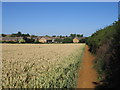
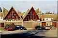
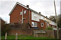
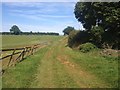
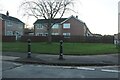
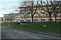
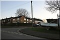
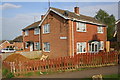
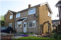
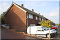
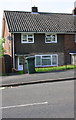
16 photos from this area
Area Information
Key information about the OX16 0LY including its size, population, and administrative classification.
- Area Type
- Postcode
- Area Size
- 3732 m²
- Population
- 1522
- Population Density
- 4008 people/km²
House Prices in OX16 0LY
13
Properties
£146,700
Average Sold Price
£34,500
Lowest Price
£217,000
Highest Price
Showing 13 properties
| Address | Type | Beds | Baths | Last Sale Price | Last Sale Date | |
|---|---|---|---|---|---|---|
| 182 Bretch Hill, Banbury, OX16 0LY | house | - | - | £217,000 | Mar 2021 | |
| 174 Bretch Hill, Banbury, OX16 0LY | Terraced | 3 | - | £192,000 | Feb 2016 | |
| 194 Bretch Hill, Banbury, OX16 0LY | Terraced | 2 | 1 | £165,000 | Jul 2015 | |
| 196 Bretch Hill, Banbury, OX16 0LY | house | - | - | £125,000 | Aug 2004 | |
| 184 Bretch Hill, Banbury, OX16 0LY | house | - | - | £34,500 | Dec 1996 | |
| 176 Bretch Hill, Banbury, OX16 0LY | house | - | - | - | - | |
| 192 Bretch Hill, Banbury, OX16 0LY | house | - | - | - | - | |
| 188 Bretch Hill, Banbury, OX16 0LY | Semi-detached | - | - | - | - | |
| 180 Bretch Hill, Banbury, OX16 0LY | house | - | - | - | - | |
| 190 Bretch Hill, Banbury, OX16 0LY | house | - | - | - | - |
Page 1 of 2
Energy Efficiency in OX16 0LY
Amenities
Schools
| Rank | School | Type | Entry gender | Ages |
|---|
Explore more schools in this area
Go to Schools tabDemographics
Household Size
Family (3-5 people)
most common
Accommodation Type
Houses
most common
Tenure
38
majority
Ethnic Group
White
most common
Religion
N/A
most common
Household Composition
N/A
most common
Age
47
median
Adults (30-64 years)
most common
Household Deprivation
N/A
with no deprivation
NS-SEC
19
in Lower managerial occupations
Explore more demographic insights in this area
Go to Demographics tabPlanning
Planning Constraints
- Flood RiskPremium
- Ramsar Wetland SitesPremium
- Area of Outstanding Natural BeautyPremium
- Protected Nature ReservePremium
- Protected WoodlandPremium