Area Overview for OX15 6QQ
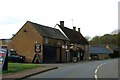
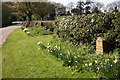
Photos of OX15 6QQ


Area Information
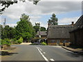
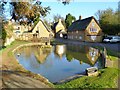
Living in OX15 6QQ offers a quiet residential experience characterised by low density and a strong sense of established community. This specific postcode covers an area of 21.4 hectares, situated within the OX15 14 postal district in the Civil Parish of Rolleigh, Banbury District, Oxfordshire. It is a small cluster of homes that feels distinctly separate from the busier attractions of Banbury town centre. The area is defined by its calm atmosphere and proximity to local amenities such as Wroxton Park, making it an ideal setting for those seeking peace away from urban noise. With a population of just 1,221, daily life revolves around neighbourhood interactions and access to nearby services rather than the hustle of a major city. The layout allows for easy integration with the surrounding village environment while maintaining privacy. Residents enjoy a setting that is spacious and uncluttered, providing a serene backdrop for family life. You are accessing a location where the pace is determined by your own schedule, not by traffic congestion or crowded footpaths. This small residential cluster prioritises comfort and stability over rapid urban development.
- Area Type
- Postcode
- Area Size
- 21.4 hectares
- Population
- 1221
- Population Density
- 61 people/km²
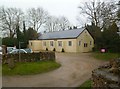
The housing market in OX15 6QQ is dominated by privately owned homes within a specific residential cluster. With 79% home ownership, the area functions primarily as a settlement for people who intend to live there for an extended period. The accommodation type consists of houses, meaning you will find detached, semi-detached, or terraced dwellings rather than flats or apartment complexes. This mix of housing types supports a variety of household needs while maintaining a consistent neighbourhood character. The small area size of 21.4 hectares limits the number of available properties, creating a selective market for potential buyers. There is no significant rental market pressure visible in the ownership data, suggesting a stable environment where sellers look for long-term tenants or future owners. Buyers looking at homes in OX15 6QQ are essentially purchasing into an established stock where prices are likely influenced by local demand rather than speculative short-term trends. The predominance of houses ensures that any sale involves a property suitable for privacy and garden space. You are entering a market defined by permanence and traditional British residential architecture rather than modern high-density living. The high ownership rate also means that maintenance and improvements are usually handled by conscientious owners who value their assets.
House Prices in OX15 6QQ
Showing 10 properties
| Address | Type | Beds | Baths | Last Sale Price | Last Sale Date | |
|---|---|---|---|---|---|---|
| Holly Barn, Dark Lane, Wroxton, OX15 6QQ | Cottage | 3 | 2 | £650,000 | May 2021 | |
| White Roses Cottage, Dark Lane, Wroxton, OX15 6QQ | Detached | - | - | £375,000 | Dec 2009 | |
| Trinity House, Dark Lane, Wroxton, OX15 6QQ | Detached | - | - | £955,000 | Jul 2005 | |
| Ladymead, Dark Lane, Wroxton, OX15 6QQ | Detached | - | - | £490,000 | Sep 2002 | |
| Mullions, Dark Lane, Wroxton, OX15 6QQ | Detached | 3 | 1 | - | - | |
| Lodge House, Dark Lane, Wroxton, OX15 6QQ | Detached | - | - | - | - | |
| South View Farmhouse, Dark Lane, Wroxton, OX15 6QQ | Cottage | 3 | - | - | - | |
| Leverton House, Dark Lane, Wroxton, OX15 6QQ | Detached | - | - | - | - | |
| South View Cottage, Dark Lane, Wroxton, OX15 6QQ | Semi-detached | - | - | - | - | |
| Laurels Farmhouse, Dark Lane, Wroxton, OX15 6QQ | house | - | - | - | - |
Energy Efficiency in OX15 6QQ
Daily life in OX15 6QQ is defined by easy access to essential amenities within a practical driving distance. You have five key retail options nearby, including Sainsburys Banbury, Co-op Hardwick, and Co-op Ruscote. These supermarkets cover groceries and household basics without requiring a journey deep into the city centre. Rail connections are also convenient, with Banbury Railway Station and Kings Sutton Railway Station being reachables for commuters or occasional travellers. Living in OX15 6QQ means you can run errands efficiently without spending hours in traffic on major motorways. The proximity to Banbury allows you to access larger shopping parks, leisure centres, restaurants, and entertainment venues when the weather is poor. Despite the quiet nature of the residential cluster, you are never more than a short drive from significant commercial hubs. Dining, shopping parks, and leisure facilities are all accessible via local roads that lead directly to these destinations. You do not need to trade convenience for peace and quiet, as the nearby amenities cater fully to a standard population of 1,221 residents.
Amenities
Schools
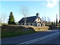
Families considering schools near OX15 6QQ benefit from the presence of local education facilities within the Banbury District. Wroxton Church of England Primary School is the nearest educational institution listed for this postcode. It is a primary school that serves the local community and offers religious education within a faith-based setting. While there is only one primary school explicitly named in the available data, it forms the backbone of early education for children living in this small residential cluster. The distance toRollco Children's Centre also noted in the broader region provides additional support services for families. For secondary education, residents of OX15 6QQ typically commute to larger towns such as Banbury, Witney, Bicester, Faringdon or Newbury, as no secondary schools are directly located within this small postcode area. The presence of a Church of England primary school indicates a value placed on traditional schooling and community cohesion. You should contact the school directly to verify current Ofsted ratings and entry requirements. The single primary option means that sending children to a maintained local school is straightforward without the complexity of choosing between multiple institutions.
| Rank | School | Type | Entry gender | Ages |
|---|
Explore more schools in this area
Go to Schools tabDemographics
The community in OX15 6QQ reflects a mature and stable neighbourhood profile. The median age of residents is 47, indicating a population dominated by adults between the ages of 30 and 64 years. This age range suggests the area is well-suited for families and older children rather than young professionals or students. Home ownership stands at an impressive 79%, showing that the vast majority of households own their property outright or with a mortgage. This high level of ownership correlates with the accommodation type, which consists almost entirely of houses. The area emphasises settled living patterns where people are likely to stay for the long term rather than renting temporarily. Diversity remains high in the UK, but within this specific cluster, the predominant ethnic group is White. The demographic structure points to a quiet, self-contained community where neighbours know each other well. Social interactions are often built around shared interests and local events rather than transitory relationships. You will find a population that has invested in their homes and taken root in the local landscape. The low population density further supports a lifestyle centred on family stability and personal space.
Household Size
Accommodation Type
Tenure
Ethnic Group
Religion
Household Composition
Age
Household Deprivation
NS-SEC
Explore more demographic insights in this area
Go to Demographics tabPlanning
Planning Constraints
- Flood RiskPremium
- Ramsar Wetland SitesPremium
- Area of Outstanding Natural BeautyPremium
- Protected Nature ReservePremium
- Protected WoodlandPremium