Area Overview for OX15 6BJ
Photos of OX15 6BJ
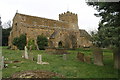
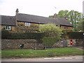
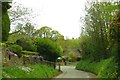
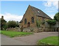
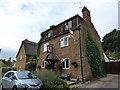
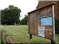
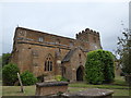
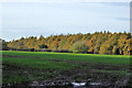
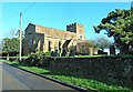
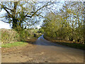
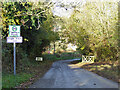
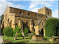
69 photos from this area
Area Information
Key information about the OX15 6BJ including its size, population, and administrative classification.
- Area Type
- Postcode
- Area Size
- 15.5 hectares
- Population
- 1082
- Population Density
- 54 people/km²
House Prices in OX15 6BJ
26
Properties
£612,286
Average Sold Price
£79,500
Lowest Price
£1,315,000
Highest Price
Showing 26 properties
| Address | Type | Beds | Baths | Last Sale Price | Last Sale Date | |
|---|---|---|---|---|---|---|
| Essex House, Hornton Lane, Horley, OX15 6BJ | Detached | 4 | 3 | £1,245,000 | Jan 2024 | |
| Quantock House, Little Lane, Horley, OX15 6BJ | house | - | - | £802,500 | Sep 2021 | |
| St Elmo, Little Lane, Horley, OX15 6BJ | Bungalow | - | - | £550,000 | Aug 2021 | |
| Park House, Hornton Lane, Horley, OX15 6BJ | Semi-detached | - | - | £765,000 | Oct 2020 | |
| Rowarth House, Little Lane, Horley, OX15 6BJ | house | - | - | £1,315,000 | Aug 2020 | |
| Field House, Little Lane, Horley, OX15 6BJ | house | - | - | £620,000 | Jul 2014 | |
| Stonecroft, Hornton Lane, Horley, OX15 6BJ | Bungalow | 4 | 1 | £390,000 | Oct 2012 | |
| Wood Cottage, Hornton Lane, Horley, OX15 6BJ | house | - | - | £400,000 | Mar 2011 | |
| Fairvale, Little Lane, Horley, OX15 6BJ | house | 5 | - | £465,000 | Nov 2010 | |
| Sunrise Corner, Hornton Lane, Horley, OX15 6BJ | Detached | - | - | £700,000 | Nov 2007 |
Page 1 of 3
Energy Efficiency in OX15 6BJ
Amenities
Schools
| Rank | School | Type | Entry gender | Ages |
|---|
Explore more schools in this area
Go to Schools tabDemographics
Household Size
Two person
most common
Accommodation Type
Houses
most common
Tenure
84
majority
Ethnic Group
White
most common
Religion
N/A
most common
Household Composition
N/A
most common
Age
47
median
Adults (30-64 years)
most common
Household Deprivation
N/A
with no deprivation
NS-SEC
45
in Lower managerial occupations
Explore more demographic insights in this area
Go to Demographics tabPlanning
Planning Constraints
- Flood RiskPremium
- Ramsar Wetland SitesPremium
- Area of Outstanding Natural BeautyPremium
- Protected Nature ReservePremium
- Protected WoodlandPremium