Area Overview for OX15 5BX
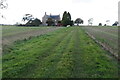
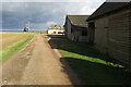
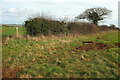
Photos of OX15 5BX
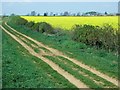
![Track to the farm [1] in OX15 5BX](https://images.propbar.co.uk/images/geograph/24/34/2434072_120.jpg)
18 photos from this area
Area Information
Key information about the OX15 5BX including its size, population, and administrative classification.
- Area Type
- Postcode
- Area Size
- 1.5 km²
- Population
- 1242
- Population Density
- 39 people/km²
House Prices in OX15 5BX
7
Properties
£1,036,250
Average Sold Price
£862,500
Lowest Price
£1,210,000
Highest Price
Showing 7 properties
| Address | Type | Beds | Baths | Last Sale Price | Last Sale Date | |
|---|---|---|---|---|---|---|
| Wychford Lodge Farm, Tadmarton Heath Road, Hook Norton, OX15 5BX | Detached | 5 | 3 | £1,210,000 | Jun 2017 | |
| Highpoint Farm, Tadmarton Heath Road, Hook Norton, OX15 5BX | house | - | - | £862,500 | Apr 2017 | |
| Cornerstones, Court Farm, Chipping Norton Road, Hook Norton, OX15 5BX | Detached | - | - | - | - | |
| Court Farm, Chipping Norton Road, Hook Norton, OX15 5BX | house | - | - | - | - | |
| The Barn At, Highpoint Farm, Tadmarton Heath Road, Hook Norton, OX15 5BX | Semi-detached | - | - | - | - | |
| Mobile Home At, Wychford Lodge Farm, Tadmarton Heath Road, Hook Norton, OX15 5BX | Mobile Home | - | - | - | - | |
| Annexe Adjacent, Court Farm, Chipping Norton Road, Hook Norton, OX15 5BX | Semi-detached | - | - | - | - |
Energy Efficiency in OX15 5BX
Amenities
Schools
| Rank | School | Type | Entry gender | Ages |
|---|
Explore more schools in this area
Go to Schools tabDemographics
Household Size
Two person
most common
Accommodation Type
Houses
most common
Tenure
82
majority
Ethnic Group
White
most common
Religion
N/A
most common
Household Composition
N/A
most common
Age
47
median
Adults (30-64 years)
most common
Household Deprivation
N/A
with no deprivation
NS-SEC
47
in Lower managerial occupations
Explore more demographic insights in this area
Go to Demographics tabPlanning
Planning Constraints
- Flood RiskPremium
- Ramsar Wetland SitesPremium
- Area of Outstanding Natural BeautyPremium
- Protected Nature ReservePremium
- Protected WoodlandPremium