Area Overview for OX15 4HA
Photos of OX15 4HA
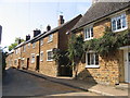
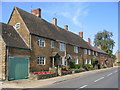
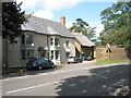
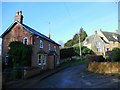
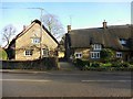

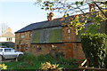
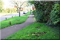
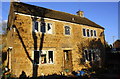
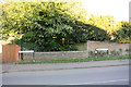
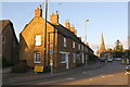
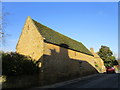
48 photos from this area
Area Information
Key information about the OX15 4HA including its size, population, and administrative classification.
- Area Type
- Postcode
- Area Size
- 7.4 hectares
- Population
- 1923
- Population Density
- 127 people/km²
House Prices in OX15 4HA
41
Properties
£166,628
Average Sold Price
£38,950
Lowest Price
£299,000
Highest Price
Showing 41 properties
| Address | Type | Beds | Baths | Last Sale Price | Last Sale Date | |
|---|---|---|---|---|---|---|
| 14 Quarry Close, Bloxham, OX15 4HA | Semi-detached | 1 | 1 | £207,500 | Sep 2025 | |
| 15 Quarry Close, Bloxham, OX15 4HA | Semi-detached | 2 | 1 | £277,000 | Sep 2025 | |
| 13 Quarry Close, Bloxham, OX15 4HA | house | 1 | 1 | £199,950 | Jan 2025 | |
| 22 Quarry Close, Bloxham, OX15 4HA | Semi-detached | 2 | 1 | £250,000 | Nov 2024 | |
| 35 Quarry Close, Bloxham, OX15 4HA | house | 2 | - | £230,000 | Oct 2021 | |
| 29 Quarry Close, Bloxham, OX15 4HA | house | - | - | £227,000 | Jun 2021 | |
| 40 Quarry Close, Bloxham, OX15 4HA | house | 2 | - | £219,000 | Sep 2020 | |
| 12 Quarry Close, Bloxham, OX15 4HA | Semi-detached | 2 | 1 | £235,000 | Mar 2020 | |
| 17 Quarry Close, Bloxham, OX15 4HA | Semi-detached | 2 | 1 | £202,500 | Nov 2019 | |
| 18 Quarry Close, Bloxham, OX15 4HA | Semi-detached | 2 | - | £160,000 | Aug 2019 |
Page 1 of 5
Energy Efficiency in OX15 4HA
Amenities
Schools
| Rank | School | Type | Entry gender | Ages |
|---|
Explore more schools in this area
Go to Schools tabDemographics
Household Size
Two person
most common
Accommodation Type
Houses
most common
Tenure
70
majority
Ethnic Group
White
most common
Religion
N/A
most common
Household Composition
N/A
most common
Age
47
median
Adults (30-64 years)
most common
Household Deprivation
N/A
with no deprivation
NS-SEC
39
in Lower managerial occupations
Explore more demographic insights in this area
Go to Demographics tabPlanning
Planning Constraints
- Flood RiskPremium
- Ramsar Wetland SitesPremium
- Area of Outstanding Natural BeautyPremium
- Protected Nature ReservePremium
- Protected WoodlandPremium