Area Overview for OX14 5DR
Photos of OX14 5DR
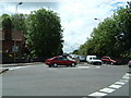
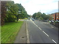
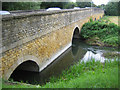
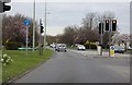

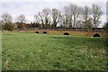

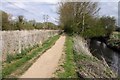
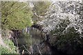
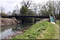
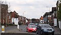
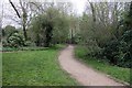
100 photos from this area
Area Information
Key information about the OX14 5DR including its size, population, and administrative classification.
- Area Type
- Postcode
- Area Size
- 2.4 hectares
- Population
- 1705
- Population Density
- 4803 people/km²
House Prices in OX14 5DR
51
Properties
£188,375
Average Sold Price
£81,000
Lowest Price
£322,500
Highest Price
Showing 51 properties
| Address | Type | Beds | Baths | Last Sale Price | Last Sale Date | |
|---|---|---|---|---|---|---|
| 272 Ock Street, Abingdon, OX14 5DR | Semi-detached | 2 | 1 | £307,000 | Feb 2022 | |
| 274 Ock Street, Abingdon, OX14 5DR | Semi-detached | 4 | - | £322,500 | Mar 2016 | |
| 196 Ock Street, Abingdon, OX14 5DR | Flat | - | - | £182,000 | Sep 2015 | |
| 192 Ock Street, Abingdon, OX14 5DR | Flat | 3 | 1 | £177,500 | Mar 2015 | |
| 186 Ock Street, Abingdon, OX14 5DR | Flat | - | - | £140,000 | Apr 2003 | |
| 200 Ock Street, Abingdon, OX14 5DR | Flat | - | - | £135,000 | Dec 2002 | |
| 194 Ock Street, Abingdon, OX14 5DR | Flat | - | - | £81,000 | Nov 2001 | |
| Kingfishers, 270A Ock Street, Abingdon, OX14 5DR | house | - | - | £162,000 | Jul 1995 | |
| Flat 5, Ock House, 266 Ock Street, Abingdon, OX14 5DR | Flat | 1 | 1 | - | - | |
| Dobbins, 270 Ock Street, Abingdon, OX14 5DR | Detached | 4 | 1 | - | - |
Page 1 of 6
Energy Efficiency in OX14 5DR
Amenities
Schools
| Rank | School | Type | Entry gender | Ages |
|---|
Explore more schools in this area
Go to Schools tabDemographics
Household Size
One person
most common
Accommodation Type
Houses
most common
Tenure
47
majority
Ethnic Group
White
most common
Religion
N/A
most common
Household Composition
N/A
most common
Age
47
median
Adults (30-64 years)
most common
Household Deprivation
N/A
with no deprivation
NS-SEC
40
in Lower managerial occupations
Explore more demographic insights in this area
Go to Demographics tabPlanning
Planning Constraints
- Flood RiskPremium
- Ramsar Wetland SitesPremium
- Area of Outstanding Natural BeautyPremium
- Protected Nature ReservePremium
- Protected WoodlandPremium