Area Overview for OX14 4SD
Photos of OX14 4SD
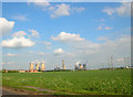
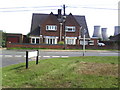
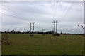
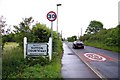
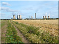
15 photos from this area
Area Information
Key information about the OX14 4SD including its size, population, and administrative classification.
- Area Type
- Postcode
- Area Size
- 37.0 hectares
- Population
- 1766
- Population Density
- 513 people/km²
House Prices in OX14 4SD
8
Properties
-
Average Sold Price
-
Lowest Price
-
Highest Price
Showing 8 properties
| Address | Type | Beds | Baths | Last Sale Price | Last Sale Date | |
|---|---|---|---|---|---|---|
| Suite D, 154D Milton Park, Milton, Abingdon, OX14 4SD | Industrial | - | - | - | - | |
| Simon Hegele Logistics & Services Ltd, 161, Brook Drive, Milton Park, Milton, Abingdon, OX14 4SD | office_workshop | - | - | - | - | |
| O B S Medical Ltd, 174-E-174-F, Brook Drive, Milton Park, Milton, Abingdon, OX14 4SD | Office | - | - | - | - | |
| Suite J, 154J Milton Park, Milton, Abingdon, OX14 4SD | Office | - | - | - | - | |
| British Gas Regulator Building, Sutton Courtenay Lane, Sutton Courtenay, Abingdon, OX14 4SD | Industrial | - | - | - | - | |
| Green Biologics Limited, 154H Milton Park, Milton, Abingdon, OX14 4SD | Office | - | - | - | - | |
| 178 Milton Park, Milton, Abingdon, OX14 4SD | office_workshop | - | - | - | - | |
| Tokamak Energy Ltd, Brook Drive, 173 Milton Park, Milton, Abingdon, OX14 4SD | warehouse | - | - | - | - |
Energy Efficiency in OX14 4SD
Amenities
Schools
| Rank | School | Type | Entry gender | Ages |
|---|
Explore more schools in this area
Go to Schools tabDemographics
Household Size
Family (3-5 people)
most common
Accommodation Type
Houses
most common
Tenure
65
majority
Ethnic Group
White
most common
Religion
N/A
most common
Household Composition
N/A
most common
Age
47
median
Adults (30-64 years)
most common
Household Deprivation
N/A
with no deprivation
NS-SEC
40
in Lower managerial occupations
Explore more demographic insights in this area
Go to Demographics tabPlanning
Planning Constraints
- Flood RiskPremium
- Ramsar Wetland SitesPremium
- Area of Outstanding Natural BeautyPremium
- Protected Nature ReservePremium
- Protected WoodlandPremium