Area Overview for OX14 4PA
Photos of OX14 4PA
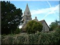
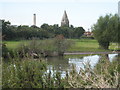
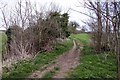

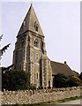


102 photos from this area
Area Information
Key information about the OX14 4PA including its size, population, and administrative classification.
- Area Type
- Postcode
- Area Size
- 52.3 hectares
- Population
- 1639
- Population Density
- 208 people/km²
House Prices in OX14 4PA
26
Properties
£448,431
Average Sold Price
£165,000
Lowest Price
£760,000
Highest Price
Showing 26 properties
| Address | Type | Beds | Baths | Last Sale Price | Last Sale Date | |
|---|---|---|---|---|---|---|
| Thatched Cottage, Church Street, Appleford, Abingdon, OX14 4PA | Detached | 3 | 1 | £699,950 | Jan 2025 | |
| Bellapais, 2 Church Street, Appleford, Abingdon, OX14 4PA | Detached | 4 | 2 | £450,000 | Jul 2024 | |
| Five Elms, Church Street, Appleford, Abingdon, OX14 4PA | Detached | 3 | 1 | £760,000 | Sep 2023 | |
| Nancekuke, Church Street, Appleford, Abingdon, OX14 4PA | house | - | - | £540,000 | Mar 2021 | |
| Woodley, 4 Church Street, Appleford, Abingdon, OX14 4PA | Detached | 4 | 1 | £410,000 | Aug 2015 | |
| Aspen, 3 Church Street, Appleford, Abingdon, OX14 4PA | Detached | - | - | £272,500 | Mar 2006 | |
| Old Well House, Church Street, Appleford, Abingdon, OX14 4PA | Detached | - | - | £290,000 | Jun 1999 | |
| Plane Tree, Church Street, Appleford, Abingdon, OX14 4PA | Detached | - | - | £165,000 | Aug 1998 | |
| Leonora, 5 Church Street, Appleford, Abingdon, OX14 4PA | Retail | 4 | 2 | - | - | |
| Acacia Court, Church Street, Appleford, Abingdon, OX14 4PA | Flat | - | - | - | - |
Page 1 of 3
Energy Efficiency in OX14 4PA
Amenities
Schools
| Rank | School | Type | Entry gender | Ages |
|---|
Explore more schools in this area
Go to Schools tabDemographics
Household Size
Two person
most common
Accommodation Type
Houses
most common
Tenure
82
majority
Ethnic Group
White
most common
Religion
N/A
most common
Household Composition
N/A
most common
Age
47
median
Adults (30-64 years)
most common
Household Deprivation
N/A
with no deprivation
NS-SEC
53
in Lower managerial occupations
Explore more demographic insights in this area
Go to Demographics tabPlanning
Planning Constraints
- Flood RiskPremium
- Ramsar Wetland SitesPremium
- Area of Outstanding Natural BeautyPremium
- Protected Nature ReservePremium
- Protected WoodlandPremium