Area Overview for OX14 3SJ
Photos of OX14 3SJ

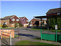
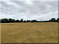
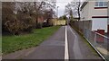
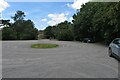
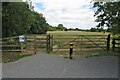
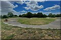
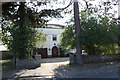
17 photos from this area
Area Information
Key information about the OX14 3SJ including its size, population, and administrative classification.
- Area Type
- Postcode
- Area Size
- 1.6 hectares
- Population
- 1395
- Population Density
- 6615 people/km²
House Prices in OX14 3SJ
34
Properties
£342,857
Average Sold Price
£79,000
Lowest Price
£648,000
Highest Price
Showing 34 properties
| Address | Type | Beds | Baths | Last Sale Price | Last Sale Date | |
|---|---|---|---|---|---|---|
| 2 St Peters Road, Abingdon, OX14 3SJ | Semi-detached | 4 | 3 | £495,000 | Mar 2023 | |
| 20 St Peters Road, Abingdon, OX14 3SJ | house | - | - | £380,000 | Mar 2021 | |
| Blagdon, St Peters Road, Abingdon, OX14 3SJ | Detached | 2 | 2 | £360,000 | Mar 2021 | |
| 1 St Peters Road, Abingdon, OX14 3SJ | house | - | - | £554,000 | Feb 2021 | |
| Uluru, St Peters Road, Abingdon, OX14 3SJ | Detached | 3 | 1 | £395,000 | Sep 2018 | |
| 9 St Peters Road, Abingdon, OX14 3SJ | Detached | 5 | 2 | £648,000 | Sep 2018 | |
| 18 St Peters Road, Abingdon, OX14 3SJ | Semi-detached | 4 | 2 | £468,500 | Sep 2015 | |
| The Orchard, St Peters Road, Abingdon, OX14 3SJ | Detached | 4 | - | £550,000 | Jul 2014 | |
| 19 St Peters Road, Abingdon, OX14 3SJ | house | - | - | £412,500 | Jun 2014 | |
| 8A St Peters Road, Abingdon, OX14 3SJ | house | 4 | - | £390,000 | Nov 2013 |
Page 1 of 4
Energy Efficiency in OX14 3SJ
Amenities
Schools
| Rank | School | Type | Entry gender | Ages |
|---|
Explore more schools in this area
Go to Schools tabDemographics
Household Size
Two person
most common
Accommodation Type
Houses
most common
Tenure
83
majority
Ethnic Group
White
most common
Religion
N/A
most common
Household Composition
N/A
most common
Age
47
median
Adults (30-64 years)
most common
Household Deprivation
N/A
with no deprivation
NS-SEC
46
in Lower managerial occupations
Explore more demographic insights in this area
Go to Demographics tabPlanning
Planning Constraints
- Flood RiskPremium
- Ramsar Wetland SitesPremium
- Area of Outstanding Natural BeautyPremium
- Protected Nature ReservePremium
- Protected WoodlandPremium