Area Overview for OX14 3AE
Photos of OX14 3AE
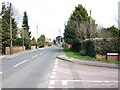


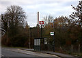
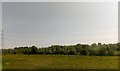
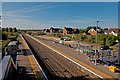
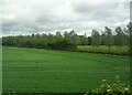

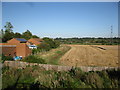

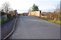
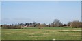
24 photos from this area
Area Information
Key information about the OX14 3AE including its size, population, and administrative classification.
- Area Type
- Postcode
- Area Size
- 2.6 hectares
- Population
- 1654
- Population Density
- 677 people/km²
House Prices in OX14 3AE
22
Properties
£325,250
Average Sold Price
£132,500
Lowest Price
£645,000
Highest Price
Showing 22 properties
| Address | Type | Beds | Baths | Last Sale Price | Last Sale Date | |
|---|---|---|---|---|---|---|
| 89 Foxborough Road, Radley, Abingdon, OX14 3AE | Bungalow | 5 | 2 | £645,000 | Feb 2024 | |
| 79 Foxborough Road, Radley, Abingdon, OX14 3AE | Bungalow | - | - | £383,000 | Nov 2017 | |
| 81 Foxborough Road, Radley, Abingdon, OX14 3AE | Bungalow | 2 | - | £370,000 | Oct 2016 | |
| 83 Foxborough Road, Radley, Abingdon, OX14 3AE | house | 5 | - | £499,500 | Mar 2015 | |
| 75A Foxborough Road, Radley, Abingdon, OX14 3AE | Detached | 5 | 1 | £260,000 | Jan 2003 | |
| 91 Foxborough Road, Radley, Abingdon, OX14 3AE | Detached | 4 | 2 | £145,000 | Jan 2002 | |
| 85 Foxborough Road, Radley, Abingdon, OX14 3AE | Detached | - | - | £167,000 | Dec 2001 | |
| 77 Foxborough Road, Radley, Abingdon, OX14 3AE | Detached | - | - | £132,500 | Oct 1999 | |
| Flat 3, 75 Foxborough Road, Radley, Abingdon, OX14 3AE | Flat | 2 | 2 | - | - | |
| Former, 75 Foxborough Road, Radley, Abingdon, OX14 3AE | undefined | - | - | - | - |
Page 1 of 3
Energy Efficiency in OX14 3AE
Amenities
Schools
| Rank | School | Type | Entry gender | Ages |
|---|
Explore more schools in this area
Go to Schools tabDemographics
Household Size
Two person
most common
Accommodation Type
Houses
most common
Tenure
73
majority
Ethnic Group
White
most common
Religion
N/A
most common
Household Composition
N/A
most common
Age
22
median
Young Adults (15-29 years)
most common
Household Deprivation
N/A
with no deprivation
NS-SEC
32
in Lower managerial occupations
Explore more demographic insights in this area
Go to Demographics tabPlanning
Planning Constraints
- Flood RiskPremium
- Ramsar Wetland SitesPremium
- Area of Outstanding Natural BeautyPremium
- Protected Nature ReservePremium
- Protected WoodlandPremium