Area Overview for OX14 1NU
Photos of OX14 1NU
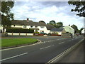
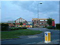
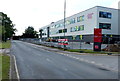
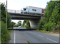
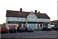
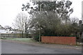

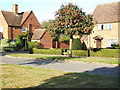
24 photos from this area
Area Information
Key information about the OX14 1NU including its size, population, and administrative classification.
- Area Type
- Postcode
- Area Size
- 8838 m²
- Population
- 1654
- Population Density
- 3509 people/km²
House Prices in OX14 1NU
20
Properties
£291,545
Average Sold Price
£70,000
Lowest Price
£530,000
Highest Price
Showing 20 properties
| Address | Type | Beds | Baths | Last Sale Price | Last Sale Date | |
|---|---|---|---|---|---|---|
| 17 Harcourt Way, Abingdon, OX14 1NU | Terraced | 4 | 2 | £530,000 | Dec 2025 | |
| 31 Harcourt Way, Abingdon, OX14 1NU | Semi-detached | 5 | 2 | £515,000 | Jun 2025 | |
| 13 Harcourt Way, Abingdon, OX14 1NU | Terraced | - | - | £300,000 | Nov 2019 | |
| 7 Harcourt Way, Abingdon, OX14 1NU | Terraced | 3 | 1 | £310,000 | Feb 2019 | |
| 19 Harcourt Way, Abingdon, OX14 1NU | Terraced | 3 | - | £320,000 | Apr 2016 | |
| 37 Harcourt Way, Abingdon, OX14 1NU | Terraced | 3 | - | £310,000 | Jun 2015 | |
| 9 Harcourt Way, Abingdon, OX14 1NU | Terraced | 3 | - | £286,000 | Dec 2014 | |
| 25 Harcourt Way, Abingdon, OX14 1NU | Terraced | - | - | £197,500 | Jan 2005 | |
| 21 Harcourt Way, Abingdon, OX14 1NU | Terraced | - | - | £218,500 | Sep 2004 | |
| 3 Harcourt Way, Abingdon, OX14 1NU | Terraced | - | - | £150,000 | Nov 2002 |
Page 1 of 2
Energy Efficiency in OX14 1NU
Amenities
Schools
| Rank | School | Type | Entry gender | Ages |
|---|
Explore more schools in this area
Go to Schools tabDemographics
Household Size
Family (3-5 people)
most common
Accommodation Type
Houses
most common
Tenure
47
majority
Ethnic Group
White
most common
Religion
N/A
most common
Household Composition
N/A
most common
Age
47
median
Adults (30-64 years)
most common
Household Deprivation
N/A
with no deprivation
NS-SEC
34
in Lower managerial occupations
Explore more demographic insights in this area
Go to Demographics tabPlanning
Planning Constraints
- Flood RiskPremium
- Ramsar Wetland SitesPremium
- Area of Outstanding Natural BeautyPremium
- Protected Nature ReservePremium
- Protected WoodlandPremium