Area Overview for OX14 1BS
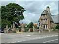
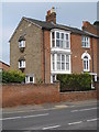
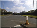
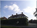
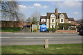
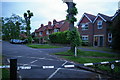
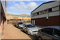
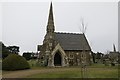
Photos of OX14 1BS

Area Information
OX14 1BS is a specific postcode area covering a small residential cluster within England. With a population of 1,425, this location offers a contained living environment rather than the expanses typical of larger towns. You will find it situated where residents rely on close-knit communities and defined boundaries for their daily routine. The area serves as a distinct pocket of housing, separate from the broader sprawl of surrounding developments. For anyone considering homes in OX14 1BS, the scale is intimate. The cluster nature means that services and neighbours are within comfortable limits of proximity without the anonymity of a large city district. Your day-to-day life here is shaped by a clear sense of place. The small population size suggests that you will notice who visits the shops and who walks the footpaths. This specificity provides a predictable environment for those who value knowing their immediate surroundings. When you look at what makes this area distinctive, the lack of suburban sprawl stands out. It is a functional residential zone designed for stability. You move through the area knowing the layout well. The compactness ensures that essential needs remain nearby. Living in OX14 1BS means accepting a smaller footprint in exchange for community visibility. The area functions as a self-contained unit rather than a extension of a larger urban centre.
- Area Type
- Postcode
- Area Size
- Not available
- Population
- 1425
- Population Density
- 1616 people/km²
The property market in OX14 1BS is defined by a strong preference for traditional housing. Sixty-six percent of residents own their homes, establishing the area as primarily owner-occupied. This dynamic significantly influences the type of housing available. The accommodation type list confirms that the streets are filled with houses rather than flats. You are unlikely to find studio apartments or shared living spaces here. The market caters to those seeking independent ownership of a single-family dwelling. Buying a home in this postcode means securing a property suited for a household rather than an investor looking for student rentals. The high ownership percentage suggests stable cash buyers rather than fluctuating rental demand. Existing structures are designed for longevity and family growth. If you consider homes in OX14 1BS, you will find stock that aligns with the resident profile. The lack of rental statistics reinforces the owner-led nature of the exchange. Sellers here are typically motivated by life changes rather than investment arbitration. The character of the market supports buyers who want to settle permanently. You secure a legacy property rather than a temporary asset. The physical layout of the housing confirms the demographic data. Houses dominate the skyline and street view. This consistency reduces the risk of mismatched expectations when viewing properties. The market operates on the assumption that you want to put down roots. Your future buyers will likely resemble your current neighbours.
House Prices in OX14 1BS
No properties found in this postcode.
Energy Efficiency in OX14 1BS
Your daily lifestyle in OX14 1BS is anchored by a practical range of retail and transport hubs. Five key retail venues fall within easy reach. You can shop at Lidl Marcham, Asda Marcham, and Tesco Abingdon. These stores provide comprehensive grocery and household essentials without a long commute. Asda and Tesco offer larger-format shopping while Lidl supplies budget-conscious options. The presence of multiple supermarkets ensures you can compare prices and stock availability. For weekly logistics, this retail cluster is your primary resource. Transport links are equally accessible, supported by four railway stations nearby. Radley Railway Station, Culham Railway Station, and Appleford Railway Station form your rail network backbone. You can plan journeys to Oxford or London with confidence from these nodes. These stations offer direct connections to the wider city and commuting corridors. The combination of five stores and three railheads creates a balanced convenience factor. You do not need to travel far for supermarkets or frequent train service. The football-related naming of Marcham for the retailers links to local identity. These amenities bring a sense of normalcy and routine to your week. You will find your weekly shop and your monthly rail ticket purchase handled efficiently. This accessibility defines the character of living in this postcode.
Amenities
Schools
Families living in OX14 1BS have access to a mix of educational institutions nearby. The area is served by Carswell Community Primary School, which holds a good Ofsted rating. This school option provides a state-funded education with a proven track record. You also find Larkmead School listed twice in local records, once as a primary institution and again as an academy. This variation in operational status may affect governance and curriculum delivery. Parents seeking independent options can consider St Helen and St Katharine. This school operates as an independent institution, offering a different fee-structured environment from the state schools. The presence of multiple primary providers and one academy gives you choices based on your educational values. The mix means you are not reliant on a single school trust. Carswell offers a community-based approach while the academy model of Larkmead School provides a performance-focused pedagogy. St Helen and St Katharine stands apart with its private sector status. For families considering schools near OX14 1BS, this variety allows you to niche your search. You can weigh the statutory duties of a community primary against the autonomy of an academy or the tradition of an independent school. The geographical proximity ensures these options are practical for daily school runs. The data confirms these four specific names are your educational satellites.
| Rank | School | Type | Entry gender | Ages |
|---|
Explore more schools in this area
Go to Schools tabDemographics
The community in OX14 1BS reflects a mature population structure centred on stability. The median age is 47 years, indicating that families tend to settle here as adults rather than young professionals moving for the first time. Most residents fall into the 30-64 years age range, which suggests households are approaching or have reached peak earning years. Home ownership stands at 66%, meaning the majority of homes are owned outright or have significant equity. This high rate of ownership contrasts sharply with rental-heavy cities. You will encounter predominantly English households within the streets. The predominant ethnic group is White, mirroring the broader demographic of the Oxon region. Accommodation types are almost exclusively houses. You will not find a concentration of flats or purpose-built high-rise blocks here. This housing stock supports a quieter lifestyle compared to apartment complexes. The absence of tenancy indicator data does not change the visible reality of owner-occupied family homes. The community feel is driven by long-term residents who have invested in their properties. This demographic profile creates a neighbourhood where stability and established routines define social interactions. Understanding the mix helps you gauge the pace of life. Buying into this section means joining a group of residents who value security and permanence over rapid turnover.
Household Size
Accommodation Type
Tenure
Ethnic Group
Religion
Household Composition
Age
Household Deprivation
NS-SEC
Explore more demographic insights in this area
Go to Demographics tabPlanning
Planning Constraints
- Flood RiskPremium
- Ramsar Wetland SitesPremium
- Area of Outstanding Natural BeautyPremium
- Protected Nature ReservePremium
- Protected WoodlandPremium