Area Overview for OX13 6SQ
Photos of OX13 6SQ
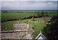
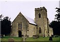

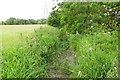

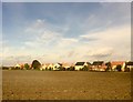
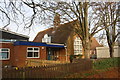

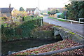
98 photos from this area
Area Information
Key information about the OX13 6SQ including its size, population, and administrative classification.
- Area Type
- Postcode
- Area Size
- 3.6 hectares
- Population
- 2117
- Population Density
- 191 people/km²
House Prices in OX13 6SQ
26
Properties
£430,145
Average Sold Price
£79,750
Lowest Price
£1,165,000
Highest Price
Showing 26 properties
| Address | Type | Beds | Baths | Last Sale Price | Last Sale Date | |
|---|---|---|---|---|---|---|
| 71 The Causeway, Steventon, Abingdon, OX13 6SQ | Semi-detached | 4 | 2 | £885,000 | Jul 2025 | |
| 124 The Causeway, Steventon, Abingdon, OX13 6SQ | Semi-detached | 2 | 1 | £355,000 | May 2024 | |
| 85 The Causeway, Steventon, Abingdon, OX13 6SQ | Retail | 2 | 1 | £213,000 | May 2023 | |
| 81 The Causeway, Steventon, Abingdon, OX13 6SQ | Semi-detached | 5 | 4 | £1,165,000 | Mar 2021 | |
| 110 The Causeway, Steventon, Abingdon, OX13 6SQ | Semi-detached | 3 | 1 | £390,000 | Feb 2021 | |
| 116 The Causeway, Steventon, Abingdon, OX13 6SQ | house | - | - | £377,500 | Oct 2020 | |
| Bramley House, The Causeway, Steventon, Abingdon, OX13 6SQ | Detached | 5 | 1 | £640,000 | Sep 2017 | |
| Worcester Barn, The Causeway, Steventon, Abingdon, OX13 6SQ | Semi-detached | 3 | 2 | £550,000 | Oct 2016 | |
| 118 The Causeway, Steventon, Abingdon, OX13 6SQ | Semi-detached | 4 | 2 | £450,000 | Jun 2016 | |
| 79 The Causeway, Steventon, Abingdon, OX13 6SQ | house | - | - | £850,000 | May 2010 |
Page 1 of 3
Energy Efficiency in OX13 6SQ
Amenities
Schools
| Rank | School | Type | Entry gender | Ages |
|---|
Explore more schools in this area
Go to Schools tabDemographics
Household Size
Family (3-5 people)
most common
Accommodation Type
Houses
most common
Tenure
67
majority
Ethnic Group
White
most common
Religion
N/A
most common
Household Composition
N/A
most common
Age
47
median
Adults (30-64 years)
most common
Household Deprivation
N/A
with no deprivation
NS-SEC
42
in Lower managerial occupations
Explore more demographic insights in this area
Go to Demographics tabPlanning
Planning Constraints
- Flood RiskPremium
- Ramsar Wetland SitesPremium
- Area of Outstanding Natural BeautyPremium
- Protected Nature ReservePremium
- Protected WoodlandPremium