Area Overview for OX13 6QG
Photos of OX13 6QG
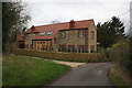
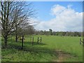
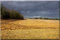
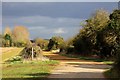
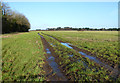
22 photos from this area
Area Information
Key information about the OX13 6QG including its size, population, and administrative classification.
- Area Type
- Postcode
- Area Size
- 1.3 km²
- Population
- 2474
- Population Density
- 243 people/km²
House Prices in OX13 6QG
12
Properties
£1,017,100
Average Sold Price
£406,000
Lowest Price
£2,800,000
Highest Price
Showing 12 properties
| Address | Type | Beds | Baths | Last Sale Price | Last Sale Date | |
|---|---|---|---|---|---|---|
| The Cedars, Sheepstead Road, Marcham, Abingdon, OX13 6QG | Detached | 4 | 3 | £1,250,000 | Jan 2023 | |
| Sheepstead Folly, Sheepstead Road, Marcham, Abingdon, OX13 6QG | Detached | 7 | - | £2,800,000 | Sep 2020 | |
| Sheepstead Lodge, Sheepstead Road, Marcham, Abingdon, OX13 6QG | Lodge | 3 | 2 | £605,000 | Apr 2019 | |
| Sheepstead House, Sheepstead Road, Marcham, Abingdon, OX13 6QG | Detached | 5 | - | £1,600,000 | Jun 2017 | |
| The Fosse, Sheepstead Road, Marcham, Abingdon, OX13 6QG | Detached | 5 | 3 | £910,000 | Jul 2015 | |
| Morland Cottage, Sheepstead Road, Marcham, Abingdon, OX13 6QG | Semi-detached | 4 | - | £720,000 | Nov 2014 | |
| Sheepstead Cottage, Sheepstead Road, Marcham, Abingdon, OX13 6QG | Cottage | 2 | 2 | £406,000 | Oct 2013 | |
| Brewers, Sheepstead Road, Marcham, Abingdon, OX13 6QG | Terraced | 5 | 2 | £630,000 | Apr 2006 | |
| Frilford Lodge, Sheepstead Road, Marcham, Abingdon, OX13 6QG | Detached | - | - | £830,000 | Jun 2004 | |
| The Clockhouse, Sheepstead Road, Marcham, Abingdon, OX13 6QG | Detached | 1 | 1 | £420,000 | Sep 1997 |
Page 1 of 2
Energy Efficiency in OX13 6QG
Amenities
Schools
| Rank | School | Type | Entry gender | Ages |
|---|
Explore more schools in this area
Go to Schools tabDemographics
Household Size
Family (3-5 people)
most common
Accommodation Type
Houses
most common
Tenure
70
majority
Ethnic Group
White
most common
Religion
N/A
most common
Household Composition
N/A
most common
Age
47
median
Adults (30-64 years)
most common
Household Deprivation
N/A
with no deprivation
NS-SEC
48
in Lower managerial occupations
Explore more demographic insights in this area
Go to Demographics tabPlanning
Planning Constraints
- Flood RiskPremium
- Ramsar Wetland SitesPremium
- Area of Outstanding Natural BeautyPremium
- Protected Nature ReservePremium
- Protected WoodlandPremium