Area Overview for OX13 5PL
Photos of OX13 5PL
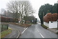
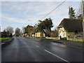
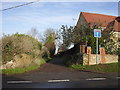
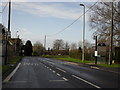
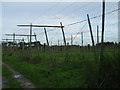
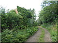

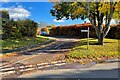
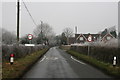
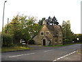
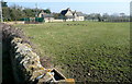
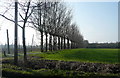
22 photos from this area
Area Information
Key information about the OX13 5PL including its size, population, and administrative classification.
- Area Type
- Postcode
- Area Size
- 16.9 hectares
- Population
- 1854
- Population Density
- 282 people/km²
House Prices in OX13 5PL
25
Properties
£723,508
Average Sold Price
£255,960
Lowest Price
£3,000,000
Highest Price
Showing 25 properties
| Address | Type | Beds | Baths | Last Sale Price | Last Sale Date | |
|---|---|---|---|---|---|---|
| 25 Wood Lane, Longworth, Abingdon, OX13 5PL | Detached | 4 | 3 | £710,000 | Sep 2025 | |
| 11 Wood Lane, Longworth, Abingdon, OX13 5PL | house | - | - | £1,270,000 | Dec 2021 | |
| 7 Wood Lane, Longworth, Abingdon, OX13 5PL | house | - | - | £785,000 | Jun 2021 | |
| 18 Wood Lane, Longworth, Abingdon, OX13 5PL | house | - | - | £554,860 | Apr 2021 | |
| 20 Wood Lane, Longworth, Abingdon, OX13 5PL | house | - | - | £541,900 | Feb 2021 | |
| 10 Wood Lane, Longworth, Abingdon, OX13 5PL | house | - | - | £433,280 | Jan 2021 | |
| 21 Wood Lane, Longworth, Abingdon, OX13 5PL | Detached | 4 | 4 | £605,100 | Dec 2020 | |
| 24 Wood Lane, Longworth, Abingdon, OX13 5PL | house | - | - | £428,500 | Nov 2020 | |
| 5 Wood Lane, Longworth, Abingdon, OX13 5PL | Flat | - | - | £670,678 | Aug 2020 | |
| 14 Wood Lane, Longworth, Abingdon, OX13 5PL | house | - | - | £512,000 | Aug 2020 |
Page 1 of 3
Energy Efficiency in OX13 5PL
Amenities
Schools
| Rank | School | Type | Entry gender | Ages |
|---|
Explore more schools in this area
Go to Schools tabDemographics
Household Size
Two person
most common
Accommodation Type
Houses
most common
Tenure
83
majority
Ethnic Group
White
most common
Religion
N/A
most common
Household Composition
N/A
most common
Age
47
median
Adults (30-64 years)
most common
Household Deprivation
N/A
with no deprivation
NS-SEC
51
in Lower managerial occupations
Explore more demographic insights in this area
Go to Demographics tabPlanning
Planning Constraints
- Flood RiskPremium
- Ramsar Wetland SitesPremium
- Area of Outstanding Natural BeautyPremium
- Protected Nature ReservePremium
- Protected WoodlandPremium