Area Overview for OX12 9QJ
Photos of OX12 9QJ
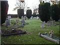
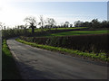
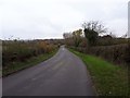
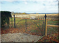
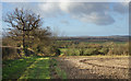
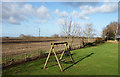
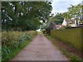
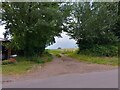
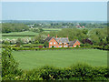

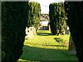

20 photos from this area
Area Information
Key information about the OX12 9QJ including its size, population, and administrative classification.
- Area Type
- Postcode
- Area Size
- 2.7 km²
- Population
- 2557
- Population Density
- 31 people/km²
House Prices in OX12 9QJ
20
Properties
£575,778
Average Sold Price
£160,000
Lowest Price
£858,000
Highest Price
Showing 20 properties
| Address | Type | Beds | Baths | Last Sale Price | Last Sale Date | |
|---|---|---|---|---|---|---|
| Foxglove Cottage, Road Running Through Fawler, Fawler, Wantage, OX12 9QJ | Detached | 4 | 2 | £858,000 | Aug 2024 | |
| Fawler Cottage, Road Running Through Fawler, Fawler, Wantage, OX12 9QJ | Flat | 1 | 1 | £642,000 | Aug 2013 | |
| Gable Cottage, Road Running Through Fawler, Fawler, Wantage, OX12 9QJ | Detached | 4 | - | £555,000 | Feb 2010 | |
| Fawler Barn, Road Running Through Fawler, Fawler, Wantage, OX12 9QJ | Flat | 1 | 1 | £587,000 | Dec 2008 | |
| Fawler Farm, Road Running Through Fawler, Fawler, Wantage, OX12 9QJ | house | - | - | £800,000 | Nov 2007 | |
| The Old Chapel, Road Running Through Fawler, Fawler, Wantage, OX12 9QJ | Detached | 2 | 1 | £375,000 | Jul 2007 | |
| Fawler End, Road Running Through Fawler, Fawler, Wantage, OX12 9QJ | house | 5 | - | £730,000 | Jan 2007 | |
| Fawler Paddock, Road Running Through Fawler, Fawler, Wantage, OX12 9QJ | Detached | 4 | 4 | £475,000 | Sep 2001 | |
| Grove Cottage, Road Running Through Fawler, Fawler, Wantage, OX12 9QJ | house | - | - | £160,000 | Jun 2001 | |
| Candleshoe, Road Running Through Fawler, Fawler, Wantage, OX12 9QJ | Detached | 4 | 2 | - | - |
Page 1 of 2
Energy Efficiency in OX12 9QJ
Amenities
Schools
| Rank | School | Type | Entry gender | Ages |
|---|
Explore more schools in this area
Go to Schools tabDemographics
Household Size
Two person
most common
Accommodation Type
Houses
most common
Tenure
69
majority
Ethnic Group
White
most common
Religion
N/A
most common
Household Composition
N/A
most common
Age
47
median
Adults (30-64 years)
most common
Household Deprivation
N/A
with no deprivation
NS-SEC
45
in Lower managerial occupations
Explore more demographic insights in this area
Go to Demographics tabPlanning
Planning Constraints
- Flood RiskPremium
- Ramsar Wetland SitesPremium
- Area of Outstanding Natural BeautyPremium
- Protected Nature ReservePremium
- Protected WoodlandPremium