Area Overview for OX12 9EN
Photos of OX12 9EN
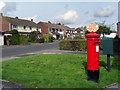
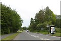

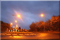

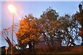
60 photos from this area
Area Information
Key information about the OX12 9EN including its size, population, and administrative classification.
- Area Type
- Postcode
- Area Size
- 3.2 hectares
- Population
- 1237
- Population Density
- 3467 people/km²
House Prices in OX12 9EN
37
Properties
£159,438
Average Sold Price
£59,500
Lowest Price
£255,000
Highest Price
Showing 37 properties
| Address | Type | Beds | Baths | Last Sale Price | Last Sale Date | |
|---|---|---|---|---|---|---|
| 29 Willow Walk, Wantage, OX12 9EN | house | - | - | £251,500 | Jul 2021 | |
| 18 Willow Walk, Wantage, OX12 9EN | Flat | - | - | £142,100 | Dec 2019 | |
| 31 Willow Walk, Wantage, OX12 9EN | Terraced | 3 | 1 | £255,000 | May 2017 | |
| 13 Willow Walk, Wantage, OX12 9EN | Flat | - | - | £189,950 | Jan 2017 | |
| 17 Willow Walk, Wantage, OX12 9EN | Maisonette | 2 | 1 | £160,000 | Dec 2015 | |
| 27 Willow Walk, Wantage, OX12 9EN | Terraced | 3 | - | £219,950 | Oct 2014 | |
| 28 Willow Walk, Wantage, OX12 9EN | Terraced | 3 | - | £205,000 | Oct 2013 | |
| 24 Willow Walk, Wantage, OX12 9EN | house | - | - | £177,000 | Oct 2009 | |
| 15 Willow Walk, Wantage, OX12 9EN | Flat | - | - | £127,500 | Sep 2009 | |
| 9 Willow Walk, Wantage, OX12 9EN | Maisonette | 2 | 1 | £110,000 | Aug 2009 |
Page 1 of 4
Energy Efficiency in OX12 9EN
Amenities
Schools
| Rank | School | Type | Entry gender | Ages |
|---|
Explore more schools in this area
Go to Schools tabDemographics
Household Size
Two person
most common
Accommodation Type
Houses
most common
Tenure
75
majority
Ethnic Group
White
most common
Religion
N/A
most common
Household Composition
N/A
most common
Age
47
median
Adults (30-64 years)
most common
Household Deprivation
N/A
with no deprivation
NS-SEC
44
in Lower managerial occupations
Explore more demographic insights in this area
Go to Demographics tabPlanning
Planning Constraints
- Flood RiskPremium
- Ramsar Wetland SitesPremium
- Area of Outstanding Natural BeautyPremium
- Protected Nature ReservePremium
- Protected WoodlandPremium