Area Overview for OX12 8GB
Photos of OX12 8GB
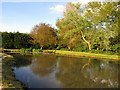
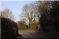
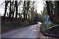
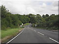
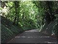
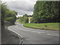
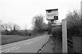
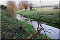
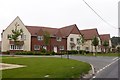
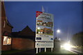
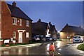
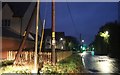
31 photos from this area
Area Information
Key information about the OX12 8GB including its size, population, and administrative classification.
- Area Type
- Postcode
- Area Size
- 5.3 hectares
- Population
- 2117
- Population Density
- 191 people/km²
House Prices in OX12 8GB
26
Properties
£509,406
Average Sold Price
£185,500
Lowest Price
£710,000
Highest Price
Showing 26 properties
| Address | Type | Beds | Baths | Last Sale Price | Last Sale Date | |
|---|---|---|---|---|---|---|
| 20 Ludbridge Close, East Hendred, Wantage, OX12 8GB | Detached | 4 | 2 | £710,000 | Aug 2025 | |
| 16 Ludbridge Close, East Hendred, Wantage, OX12 8GB | Detached | 3 | 2 | £495,000 | Feb 2024 | |
| 12 Ludbridge Close, East Hendred, Wantage, OX12 8GB | Detached | 4 | 2 | £662,500 | Jun 2023 | |
| 17 Ludbridge Close, East Hendred, Wantage, OX12 8GB | Detached | 3 | 2 | £527,500 | Aug 2022 | |
| 10 Ludbridge Close, East Hendred, Wantage, OX12 8GB | house | - | - | £630,000 | Aug 2022 | |
| 25 Ludbridge Close, East Hendred, Wantage, OX12 8GB | Terraced | 2 | 1 | £185,500 | Jun 2022 | |
| 14 Ludbridge Close, East Hendred, Wantage, OX12 8GB | house | - | - | £450,000 | May 2021 | |
| 19 Ludbridge Close, East Hendred, Wantage, OX12 8GB | house | - | - | £510,000 | Dec 2017 | |
| 18 Ludbridge Close, East Hendred, Wantage, OX12 8GB | house | - | - | £505,000 | Oct 2017 | |
| 21 Ludbridge Close, East Hendred, Wantage, OX12 8GB | Detached | 4 | 2 | £540,000 | Oct 2017 |
Page 1 of 3
Energy Efficiency in OX12 8GB
Amenities
Schools
| Rank | School | Type | Entry gender | Ages |
|---|
Explore more schools in this area
Go to Schools tabDemographics
Household Size
Family (3-5 people)
most common
Accommodation Type
Houses
most common
Tenure
67
majority
Ethnic Group
White
most common
Religion
N/A
most common
Household Composition
N/A
most common
Age
47
median
Adults (30-64 years)
most common
Household Deprivation
N/A
with no deprivation
NS-SEC
42
in Lower managerial occupations
Explore more demographic insights in this area
Go to Demographics tabPlanning
Planning Constraints
- Flood RiskPremium
- Ramsar Wetland SitesPremium
- Area of Outstanding Natural BeautyPremium
- Protected Nature ReservePremium
- Protected WoodlandPremium