Area Overview for OX12 7GS
Photos of OX12 7GS
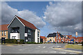
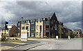
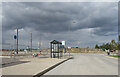

36 photos from this area
Area Information
Key information about the OX12 7GS including its size, population, and administrative classification.
- Area Type
- Postcode
- Area Size
- 1.8 hectares
- Population
- 1712
- Population Density
- 2787 people/km²
House Prices in OX12 7GS
55
Properties
£350,370
Average Sold Price
£153,129
Lowest Price
£595,000
Highest Price
Showing 55 properties
| Address | Type | Beds | Baths | Last Sale Price | Last Sale Date | |
|---|---|---|---|---|---|---|
| 15 Flowe Drive, Wantage, OX12 7GS | house | - | - | £294,350 | May 2024 | |
| 58 Flowe Drive, Wantage, OX12 7GS | Semi-detached | 2 | 2 | £332,500 | Apr 2024 | |
| 37 Flowe Drive, Wantage, OX12 7GS | house | - | - | £351,441 | Mar 2024 | |
| 34 Flowe Drive, Wantage, OX12 7GS | house | - | - | £399,995 | Jan 2024 | |
| 44 Flowe Drive, Wantage, OX12 7GS | house | - | - | £595,000 | Jul 2023 | |
| 48 Flowe Drive, Wantage, OX12 7GS | house | - | - | £570,000 | Jun 2023 | |
| 6 Flowe Drive, Wantage, OX12 7GS | Semi-detached | 2 | 2 | £332,500 | Apr 2023 | |
| 28 Flowe Drive, Wantage, OX12 7GS | house | - | - | £345,000 | Nov 2022 | |
| 26 Flowe Drive, Wantage, OX12 7GS | house | - | - | £355,000 | Oct 2022 | |
| 24 Flowe Drive, Wantage, OX12 7GS | house | - | - | £419,000 | Sep 2022 |
Page 1 of 6
Energy Efficiency in OX12 7GS
Amenities
Schools
| Rank | School | Type | Entry gender | Ages |
|---|
Explore more schools in this area
Go to Schools tabDemographics
Household Size
Family (3-5 people)
most common
Accommodation Type
Houses
most common
Tenure
88
majority
Ethnic Group
White
most common
Religion
N/A
most common
Household Composition
N/A
most common
Age
47
median
Adults (30-64 years)
most common
Household Deprivation
N/A
with no deprivation
NS-SEC
42
in Lower managerial occupations
Explore more demographic insights in this area
Go to Demographics tabPlanning
Planning Constraints
- Flood RiskPremium
- Ramsar Wetland SitesPremium
- Area of Outstanding Natural BeautyPremium
- Protected Nature ReservePremium
- Protected WoodlandPremium