Area Overview for OX12 7FN
Photos of OX12 7FN

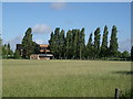
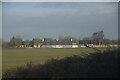
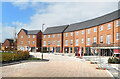
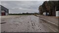
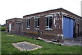
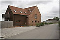
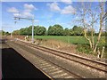
15 photos from this area
Area Information
Key information about the OX12 7FN including its size, population, and administrative classification.
- Area Type
- Postcode
- Area Size
- 5.6 hectares
- Population
- 2233
- Population Density
- 456 people/km²
House Prices in OX12 7FN
42
Properties
£527,569
Average Sold Price
£275,000
Lowest Price
£770,000
Highest Price
Showing 42 properties
| Address | Type | Beds | Baths | Last Sale Price | Last Sale Date | |
|---|---|---|---|---|---|---|
| 16 Keel Drive, Grove, Wantage, OX12 7FN | Detached | 3 | 2 | £383,000 | Aug 2025 | |
| 51 Keel Drive, Grove, Wantage, OX12 7FN | Detached | 5 | 3 | £630,000 | Jan 2024 | |
| 7 Keel Drive, Grove, Wantage, OX12 7FN | house | - | - | £547,500 | Jun 2023 | |
| 29 Keel Drive, Grove, Wantage, OX12 7FN | Retail | 3 | 2 | £457,500 | Nov 2022 | |
| 47 Keel Drive, Grove, Wantage, OX12 7FN | house | - | - | £770,000 | Mar 2022 | |
| 22 Keel Drive, Grove, Wantage, OX12 7FN | house | - | - | £649,000 | Feb 2022 | |
| 3 Keel Drive, Grove, Wantage, OX12 7FN | house | - | - | £685,000 | Feb 2022 | |
| 45 Keel Drive, Grove, Wantage, OX12 7FN | house | - | - | £660,000 | Jan 2022 | |
| 49 Keel Drive, Grove, Wantage, OX12 7FN | house | - | - | £757,000 | Nov 2021 | |
| 43 Keel Drive, Grove, Wantage, OX12 7FN | Detached | - | - | £767,000 | Nov 2021 |
Page 1 of 5
Energy Efficiency in OX12 7FN
Amenities
Schools
| Rank | School | Type | Entry gender | Ages |
|---|
Explore more schools in this area
Go to Schools tabDemographics
Household Size
Two person
most common
Accommodation Type
Houses
most common
Tenure
72
majority
Ethnic Group
White
most common
Religion
N/A
most common
Household Composition
N/A
most common
Age
47
median
Adults (30-64 years)
most common
Household Deprivation
N/A
with no deprivation
NS-SEC
40
in Lower managerial occupations
Explore more demographic insights in this area
Go to Demographics tabPlanning
Planning Constraints
- Flood RiskPremium
- Ramsar Wetland SitesPremium
- Area of Outstanding Natural BeautyPremium
- Protected Nature ReservePremium
- Protected WoodlandPremium