Area Overview for OX12 0HX
Photos of OX12 0HX
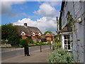
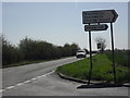

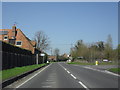

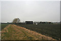
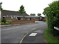
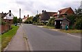


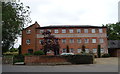
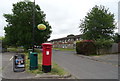
44 photos from this area
Area Information
Key information about the OX12 0HX including its size, population, and administrative classification.
- Area Type
- Postcode
- Area Size
- 3.1 hectares
- Population
- 2865
- Population Density
- 76 people/km²
House Prices in OX12 0HX
19
Properties
£595,719
Average Sold Price
£340,000
Lowest Price
£1,087,500
Highest Price
Showing 19 properties
| Address | Type | Beds | Baths | Last Sale Price | Last Sale Date | |
|---|---|---|---|---|---|---|
| Lower Manor, Main Street, East Hanney, Wantage, OX12 0HX | Detached | 5 | 2 | £1,087,500 | Dec 2025 | |
| Orchard View, Main Street, East Hanney, Wantage, OX12 0HX | house | - | - | £792,500 | Aug 2021 | |
| Tanglin Cottage, Main Street, East Hanney, Wantage, OX12 0HX | house | - | - | £475,000 | Jun 2019 | |
| Burnaby, Main Street, East Hanney, Wantage, OX12 0HX | Detached | 4 | 3 | £715,000 | Nov 2017 | |
| Willow Cottage, Main Street, East Hanney, Wantage, OX12 0HX | Detached | 3 | 1 | £405,750 | Jul 2017 | |
| Chapel Cottage, Main Street, East Hanney, Wantage, OX12 0HX | Cottage | 3 | 1 | £475,000 | Jul 2015 | |
| The Old Post Office, Main Street, East Hanney, Wantage, OX12 0HX | Detached | 3 | - | £475,000 | Mar 2014 | |
| Sunny Bank Cottage, Main Street, East Hanney, Wantage, OX12 0HX | Detached | - | - | £340,000 | Jun 2000 | |
| 4, The Paddocks, Main Street, East Hanney, Wantage, OX12 0HX | Detached | 3 | 3 | - | - | |
| 4A, The Paddocks, Main Street, East Hanney, Wantage, OX12 0HX | Detached | 4 | 3 | - | - |
Page 1 of 2
Energy Efficiency in OX12 0HX
Amenities
Schools
| Rank | School | Type | Entry gender | Ages |
|---|
Explore more schools in this area
Go to Schools tabDemographics
Household Size
Two person
most common
Accommodation Type
Houses
most common
Tenure
80
majority
Ethnic Group
White
most common
Religion
N/A
most common
Household Composition
N/A
most common
Age
47
median
Adults (30-64 years)
most common
Household Deprivation
N/A
with no deprivation
NS-SEC
51
in Lower managerial occupations
Explore more demographic insights in this area
Go to Demographics tabPlanning
Planning Constraints
- Flood RiskPremium
- Ramsar Wetland SitesPremium
- Area of Outstanding Natural BeautyPremium
- Protected Nature ReservePremium
- Protected WoodlandPremium