Area Overview for OX12 0GD
Photos of OX12 0GD
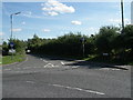
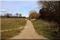

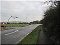

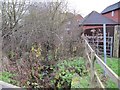
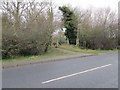

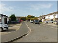
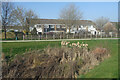
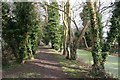
52 photos from this area
Area Information
Key information about the OX12 0GD including its size, population, and administrative classification.
- Area Type
- Postcode
- Area Size
- 7.3 hectares
- Population
- 2909
- Population Density
- 1646 people/km²
House Prices in OX12 0GD
25
Properties
£300,747
Average Sold Price
£240,000
Lowest Price
£357,995
Highest Price
Showing 25 properties
| Address | Type | Beds | Baths | Last Sale Price | Last Sale Date | |
|---|---|---|---|---|---|---|
| 18 Horsa Close, Grove, Wantage, OX12 0GD | Terraced | 2 | 1 | £258,000 | Dec 2024 | |
| 1 Horsa Close, Grove, Wantage, OX12 0GD | Detached | 3 | 2 | £350,000 | Mar 2022 | |
| 16 Horsa Close, Grove, Wantage, OX12 0GD | house | - | - | £240,000 | Jun 2021 | |
| 17 Horsa Close, Grove, Wantage, OX12 0GD | house | - | - | £265,000 | Jun 2020 | |
| 11 Horsa Close, Grove, Wantage, OX12 0GD | house | - | - | £246,995 | Jan 2020 | |
| 22 Horsa Close, Grove, Wantage, OX12 0GD | house | - | - | £309,995 | Dec 2019 | |
| 9 Horsa Close, Grove, Wantage, OX12 0GD | Semi-detached | 2 | 1 | £244,000 | Nov 2019 | |
| 23 Horsa Close, Grove, Wantage, OX12 0GD | house | - | - | £343,995 | Nov 2019 | |
| 15 Horsa Close, Grove, Wantage, OX12 0GD | house | - | - | £274,995 | Aug 2019 | |
| 20 Horsa Close, Grove, Wantage, OX12 0GD | house | - | - | £261,995 | Jun 2019 |
Page 1 of 3
Energy Efficiency in OX12 0GD
Amenities
Schools
| Rank | School | Type | Entry gender | Ages |
|---|
Explore more schools in this area
Go to Schools tabDemographics
Household Size
Family (3-5 people)
most common
Accommodation Type
Houses
most common
Tenure
67
majority
Ethnic Group
White
most common
Religion
N/A
most common
Household Composition
N/A
most common
Age
47
median
Adults (30-64 years)
most common
Household Deprivation
N/A
with no deprivation
NS-SEC
39
in Lower managerial occupations
Explore more demographic insights in this area
Go to Demographics tabPlanning
Planning Constraints
- Flood RiskPremium
- Ramsar Wetland SitesPremium
- Area of Outstanding Natural BeautyPremium
- Protected Nature ReservePremium
- Protected WoodlandPremium