Area Overview for OX11 7UU
Photos of OX11 7UU
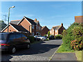
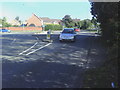
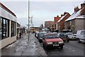
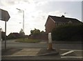


100 photos from this area
Area Information
Key information about the OX11 7UU including its size, population, and administrative classification.
- Area Type
- Postcode
- Area Size
- 5424 m²
- Population
- 1426
- Population Density
- 5174 people/km²
House Prices in OX11 7UU
19
Properties
£209,040
Average Sold Price
£69,995
Lowest Price
£380,000
Highest Price
Showing 19 properties
| Address | Type | Beds | Baths | Last Sale Price | Last Sale Date | |
|---|---|---|---|---|---|---|
| 22 Dearne Place, Didcot, OX11 7UU | Semi-detached | 3 | 1 | £380,000 | Mar 2025 | |
| 16 Dearne Place, Didcot, OX11 7UU | Retail | 2 | 1 | £305,000 | Nov 2022 | |
| 18 Dearne Place, Didcot, OX11 7UU | Semi-detached | 3 | 1 | £285,000 | Dec 2019 | |
| 9 Dearne Place, Didcot, OX11 7UU | Detached | 3 | 2 | £320,000 | Dec 2019 | |
| 6 Dearne Place, Didcot, OX11 7UU | Semi-detached | 2 | - | £258,500 | Jun 2018 | |
| 3 Dearne Place, Didcot, OX11 7UU | Semi-detached | 2 | 1 | £270,000 | Apr 2018 | |
| 2 Dearne Place, Didcot, OX11 7UU | Semi-detached | 2 | 1 | £279,950 | Jan 2017 | |
| 10 Dearne Place, Didcot, OX11 7UU | Semi-detached | 2 | 1 | £250,000 | Nov 2016 | |
| 1 Dearne Place, Didcot, OX11 7UU | Semi-detached | 2 | - | £225,000 | Oct 2014 | |
| 20 Dearne Place, Didcot, OX11 7UU | Semi-detached | 3 | 1 | £265,000 | Mar 2014 |
Page 1 of 2
Energy Efficiency in OX11 7UU
Amenities
Schools
| Rank | School | Type | Entry gender | Ages |
|---|
Explore more schools in this area
Go to Schools tabDemographics
Household Size
Two person
most common
Accommodation Type
Houses
most common
Tenure
65
majority
Ethnic Group
White
most common
Religion
N/A
most common
Household Composition
N/A
most common
Age
47
median
Adults (30-64 years)
most common
Household Deprivation
N/A
with no deprivation
NS-SEC
43
in Lower managerial occupations
Explore more demographic insights in this area
Go to Demographics tabPlanning
Planning Constraints
- Flood RiskPremium
- Ramsar Wetland SitesPremium
- Area of Outstanding Natural BeautyPremium
- Protected Nature ReservePremium
- Protected WoodlandPremium