Area Overview for OX11 7SN
Photos of OX11 7SN
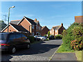
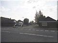

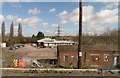
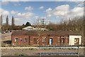
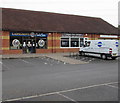
100 photos from this area
Area Information
Key information about the OX11 7SN including its size, population, and administrative classification.
- Area Type
- Postcode
- Area Size
- 1.0 hectares
- Population
- 1742
- Population Density
- 1085 people/km²
House Prices in OX11 7SN
25
Properties
£282,850
Average Sold Price
£105,000
Lowest Price
£485,000
Highest Price
Showing 25 properties
| Address | Type | Beds | Baths | Last Sale Price | Last Sale Date | |
|---|---|---|---|---|---|---|
| 10 Westwater Way, Didcot, OX11 7SN | house | 4 | 2 | £485,000 | Oct 2022 | |
| 35 Westwater Way, Didcot, OX11 7SN | Detached | 4 | 2 | £415,000 | Dec 2020 | |
| 27 Westwater Way, Didcot, OX11 7SN | Detached | 4 | 2 | £420,000 | Oct 2019 | |
| 1 Westwater Way, Didcot, OX11 7SN | Detached | 3 | 1 | £297,500 | Mar 2019 | |
| 2 Westwater Way, Didcot, OX11 7SN | Detached | 4 | 2 | £372,000 | Mar 2019 | |
| 19 Westwater Way, Didcot, OX11 7SN | Detached | 4 | 3 | £440,000 | Jul 2018 | |
| 33 Westwater Way, Didcot, OX11 7SN | Detached | 4 | 2 | £370,000 | Feb 2018 | |
| 17 Westwater Way, Didcot, OX11 7SN | Detached | 3 | 1 | £300,000 | Dec 2017 | |
| 31 Westwater Way, Didcot, OX11 7SN | Detached | 4 | 2 | £388,000 | Jul 2013 | |
| 21 Westwater Way, Didcot, OX11 7SN | house | 3 | - | £260,000 | Sep 2012 |
Page 1 of 3
Energy Efficiency in OX11 7SN
Amenities
Schools
| Rank | School | Type | Entry gender | Ages |
|---|
Explore more schools in this area
Go to Schools tabDemographics
Household Size
Family (3-5 people)
most common
Accommodation Type
Houses
most common
Tenure
74
majority
Ethnic Group
White
most common
Religion
N/A
most common
Household Composition
N/A
most common
Age
47
median
Adults (30-64 years)
most common
Household Deprivation
N/A
with no deprivation
NS-SEC
48
in Lower managerial occupations
Explore more demographic insights in this area
Go to Demographics tabPlanning
Planning Constraints
- Flood RiskPremium
- Ramsar Wetland SitesPremium
- Area of Outstanding Natural BeautyPremium
- Protected Nature ReservePremium
- Protected WoodlandPremium