Area Overview for OX11 6JP
Photos of OX11 6JP

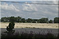
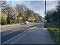
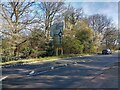
58 photos from this area
Area Information
Key information about the OX11 6JP including its size, population, and administrative classification.
- Area Type
- Postcode
- Area Size
- 1.1 hectares
- Population
- 1804
- Population Density
- 2448 people/km²
House Prices in OX11 6JP
26
Properties
£431,764
Average Sold Price
£297,000
Lowest Price
£620,000
Highest Price
Showing 26 properties
| Address | Type | Beds | Baths | Last Sale Price | Last Sale Date | |
|---|---|---|---|---|---|---|
| 8 Durnells, Didcot, OX11 6JP | Detached | 4 | 2 | £587,500 | Jun 2025 | |
| 7 Durnells, Didcot, OX11 6JP | Semi-detached | 2 | 2 | £330,000 | Oct 2024 | |
| 33 Durnells, Didcot, OX11 6JP | house | - | - | £620,000 | Jun 2021 | |
| 31 Durnells, Didcot, OX11 6JP | house | - | - | £400,000 | Jun 2021 | |
| 20 Durnells, Didcot, OX11 6JP | house | - | - | £352,000 | Mar 2021 | |
| 18 Durnells, Didcot, OX11 6JP | house | - | - | £390,000 | Feb 2021 | |
| 16 Durnells, Didcot, OX11 6JP | house | - | - | £495,000 | Jan 2021 | |
| 12 Durnells, Didcot, OX11 6JP | house | - | - | £350,000 | Dec 2020 | |
| 14 Durnells, Didcot, OX11 6JP | house | - | - | £399,000 | Dec 2020 | |
| 10 Durnells, Didcot, OX11 6JP | house | - | - | £353,000 | Dec 2020 |
Page 1 of 3
Energy Efficiency in OX11 6JP
Amenities
Schools
| Rank | School | Type | Entry gender | Ages |
|---|
Explore more schools in this area
Go to Schools tabDemographics
Household Size
Family (3-5 people)
most common
Accommodation Type
Houses
most common
Tenure
57
majority
Ethnic Group
White
most common
Religion
N/A
most common
Household Composition
N/A
most common
Age
47
median
Adults (30-64 years)
most common
Household Deprivation
N/A
with no deprivation
NS-SEC
37
in Lower managerial occupations
Explore more demographic insights in this area
Go to Demographics tabPlanning
Planning Constraints
- Flood RiskPremium
- Ramsar Wetland SitesPremium
- Area of Outstanding Natural BeautyPremium
- Protected Nature ReservePremium
- Protected WoodlandPremium