Area Overview for OX11 0RT
Photos of OX11 0RT
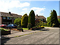

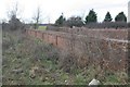

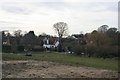

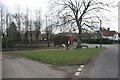


79 photos from this area
Area Information
Key information about the OX11 0RT including its size, population, and administrative classification.
- Area Type
- Postcode
- Area Size
- 35.1 hectares
- Population
- 1888
- Population Density
- 244 people/km²
House Prices in OX11 0RT
49
Properties
£423,994
Average Sold Price
£56,500
Lowest Price
£1,275,000
Highest Price
Showing 49 properties
| Address | Type | Beds | Baths | Last Sale Price | Last Sale Date | |
|---|---|---|---|---|---|---|
| 1 South Row, Chilton, Didcot, OX11 0RT | Semi-detached | 3 | 1 | £345,000 | Oct 2024 | |
| Downs View, South Row, Chilton, Didcot, OX11 0RT | Semi-detached | 4 | 2 | £475,000 | Jul 2024 | |
| 2 South Row, Chilton, Didcot, OX11 0RT | Semi-detached | 3 | 2 | £357,500 | Mar 2024 | |
| Wayland, South Row, Chilton, Didcot, OX11 0RT | Bungalow | - | - | £505,000 | Dec 2023 | |
| Kilbo, South Row, Chilton, Didcot, OX11 0RT | Retail | 5 | 4 | £900,000 | Sep 2022 | |
| The Heathers, South Row, Chilton, Didcot, OX11 0RT | Detached | 5 | 4 | £510,000 | Sep 2022 | |
| Windrush, South Row, Chilton, Didcot, OX11 0RT | Bungalow | - | - | £635,000 | Jun 2022 | |
| 13 South Row, Chilton, Didcot, OX11 0RT | Terraced | 3 | 1 | £263,000 | May 2021 | |
| Ardarragh House, South Row, Chilton, Didcot, OX11 0RT | Bungalow | - | - | £963,500 | Mar 2021 | |
| Dormers, South Row, Chilton, Didcot, OX11 0RT | Semi-detached | 3 | 2 | £449,450 | Feb 2021 |
Page 1 of 5
Energy Efficiency in OX11 0RT
Amenities
Schools
| Rank | School | Type | Entry gender | Ages |
|---|
Explore more schools in this area
Go to Schools tabDemographics
Household Size
Family (3-5 people)
most common
Accommodation Type
Houses
most common
Tenure
76
majority
Ethnic Group
White
most common
Religion
N/A
most common
Household Composition
N/A
most common
Age
47
median
Adults (30-64 years)
most common
Household Deprivation
N/A
with no deprivation
NS-SEC
54
in Lower managerial occupations
Explore more demographic insights in this area
Go to Demographics tabPlanning
Planning Constraints
- Flood RiskPremium
- Ramsar Wetland SitesPremium
- Area of Outstanding Natural BeautyPremium
- Protected Nature ReservePremium
- Protected WoodlandPremium