Area Overview for OX11 0NP
Photos of OX11 0NP

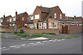
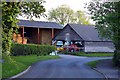

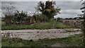
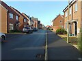
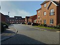

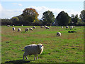
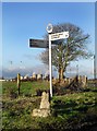
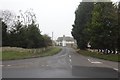
24 photos from this area
Area Information
Key information about the OX11 0NP including its size, population, and administrative classification.
- Area Type
- Postcode
- Area Size
- 35.6 hectares
- Population
- 1186
- Population Density
- 213 people/km²
House Prices in OX11 0NP
11
Properties
£419,000
Average Sold Price
£220,000
Lowest Price
£635,000
Highest Price
Showing 11 properties
| Address | Type | Beds | Baths | Last Sale Price | Last Sale Date | |
|---|---|---|---|---|---|---|
| 1, Coscote Cottages, Road Running Through Coscote, Coscote, Didcot, OX11 0NP | Semi-detached | 3 | 2 | £432,000 | Mar 2024 | |
| Coscote Manor, Road Running Through Coscote, Coscote, Didcot, OX11 0NP | Semi-detached | - | - | £635,000 | May 2021 | |
| Herdwick House, Road Running Through Coscote, Coscote, Didcot, OX11 0NP | Bungalow | - | - | £400,000 | Jun 2008 | |
| Ashdown, Road Running Through Coscote, Coscote, Didcot, OX11 0NP | Detached | - | - | £408,000 | Nov 2007 | |
| Old Cross House, Road Running Through Coscote, Coscote, Didcot, OX11 0NP | Land | - | - | £220,000 | Jul 1998 | |
| Flat, Coscote Farm, Road Running Through Coscote, Coscote, Didcot, OX11 0NP | Flat | - | - | - | - | |
| Westfield, Road Running Through Coscote, Coscote, Didcot, OX11 0NP | Bungalow | - | - | - | - | |
| Yew Tree Farm, Road Running Through Coscote, Coscote, Didcot, OX11 0NP | Semi-detached | - | - | - | - | |
| Coscote Farm, Road Running Through Coscote, Coscote, Didcot, OX11 0NP | Farm | - | - | - | - | |
| 2, Coscote Cottages, Road Running Through Coscote, Coscote, Didcot, OX11 0NP | Semi-detached | - | - | - | - |
Page 1 of 2
Energy Efficiency in OX11 0NP
Amenities
Schools
| Rank | School | Type | Entry gender | Ages |
|---|
Explore more schools in this area
Go to Schools tabDemographics
Household Size
Two person
most common
Accommodation Type
Houses
most common
Tenure
79
majority
Ethnic Group
White
most common
Religion
N/A
most common
Household Composition
N/A
most common
Age
47
median
Adults (30-64 years)
most common
Household Deprivation
N/A
with no deprivation
NS-SEC
45
in Lower managerial occupations
Explore more demographic insights in this area
Go to Demographics tabPlanning
Planning Constraints
- Flood RiskPremium
- Ramsar Wetland SitesPremium
- Area of Outstanding Natural BeautyPremium
- Protected Nature ReservePremium
- Protected WoodlandPremium