Area Overview for OX11 0JL
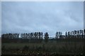
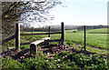
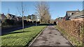
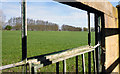
Photos of OX11 0JL


Area Information
OX11 0JL is a compact residential cluster covering just 6.8 hectares in Oxfordshire. You will find 1609 residents living within this small footprint, creating a density of 452 people per square kilometre. This postcode represents a specific, contained neighbourhood rather than a sprawling district. The area offers a quiet, intimate setting where daily life moves at a manageable pace. You are surrounded by familiar streets and a clear sense of place, distinct from the wider Didcot landscape. Living in OX11 0JL means prioritising immediate access to your local environment over large-scale urban development. The scale of the area ensures you know your neighbours and understand the rhythm of the locality. This small size makes it easy to maintain a connection to your home and community without the anonymity of a larger town centre.
- Area Type
- Postcode
- Area Size
- 6.8 hectares
- Population
- 1609
- Population Density
- 452 people/km²
The property market in OX11 0JL is defined by a strong emphasis on ownership. Houses make up the primary accommodation type, meaning the streets are lined with detached or semi-detached family properties rather than Purpose-built flats. With 78 per cent of residents owning their homes, this area is not a rental hotspot. You will find few private landlords here; instead, the market caters to buyers seeking permanence. This high ownership rate implies that houses in OX11 0JL are generally bought to stay, not flipped quickly for profit. The concentration of houses also suggests a built environment designed for single-family living. When looking for homes in OX11 0JL, you should expect a traditional suburban feel with gardens and private outdoor space. The market is stable, driven by owners who understand the value of their local properties. This makes OX11 0JL a sensible choice for buyers prioritising security of tenure over investment speculation.
House Prices in OX11 0JL
Showing 11 properties
| Address | Type | Beds | Baths | Last Sale Price | Last Sale Date | |
|---|---|---|---|---|---|---|
| Merlin, Reading Road, Harwell, Didcot, OX11 0JL | Bungalow | 3 | 1 | £370,000 | Jul 2024 | |
| The Cot, Reading Road, Harwell, Didcot, OX11 0JL | Detached | 4 | 2 | £675,000 | Oct 2022 | |
| Site Of The Firs, Reading Road, Harwell, Didcot, OX11 0JL | Bungalow | 2 | 1 | £295,000 | Jul 2018 | |
| Alvie, Reading Road, Harwell, Didcot, OX11 0JL | Bungalow | 3 | 1 | £425,000 | Aug 2017 | |
| Pinjaur, Reading Road, Harwell, Didcot, OX11 0JL | Detached | 3 | 2 | £355,000 | Mar 2015 | |
| The Conifers, 5 Reading Road, Harwell, Didcot, OX11 0JL | Detached | 2 | 1 | - | - | |
| Hill View, Reading Road, Harwell, Didcot, OX11 0JL | Bungalow | - | - | - | - | |
| Pax Vobis, Reading Road, Harwell, Didcot, OX11 0JL | Detached | - | - | - | - | |
| Harleigh, Reading Road, Harwell, Didcot, OX11 0JL | Detached | - | - | - | - | |
| Applecross, Reading Road, Harwell, Didcot, OX11 0JL | house | - | - | - | - |
Energy Efficiency in OX11 0JL
Residents of OX11 0JL enjoy practical access to essential services within a short drive or walk. Retail options include Morrisons Daily, M&S Milton Heights Belfast BP, and Asda Didcot. These five nearby shops provide everything from groceries to household goods. For travel, three railway stations serve the area: Didcot Parkway Railway Station, Appleford Railway Station, and Culham Railway Station. These rail links connect you to the wider network efficiently. You have immediate access to supermarkets and transport hubs without needing to travel far. This proximity to M&S Milton Heights Belfast BP and other retailers means your errands are never a major undertaking. The lifestyle here blends suburban convenience with the option to use public transport when necessary. You can enjoy local shopping while retaining your connection to the national rail system. This balance supports a self-sufficient daily routine that does not rely heavily on a private car for every task.
Amenities
Schools
Families in OX11 0JL have access to a specific, limited number of educational institutions. Harwell Primary School stands as the key nearby option for primary education. This school holds a Good rating from Ofsted, confirming its quality. As the only school listed within practical reach, this institution serves the immediate educational needs of children growing up in the OX11 0JL postcode. You will not find secondary schools on the immediate doorstep of this specific area. The reliance on Harwell Primary School means that residential and school zones are closely linked. This singular focus simplifies decision-making for parents, as your children will attend a known, rated establishment close to home. The Good rating provides a clear indicator of educational standards for families considering living in OX11 0JL. This setup supports a community where primary education is a straightforward part of daily life, without the need for complex catchment area navigation for this specific stage.
| Rank | School | Type | Entry gender | Ages |
|---|
Explore more schools in this area
Go to Schools tabDemographics
The community in OX11 0JL reflects a settled, long-established population. The median age is 47 years, with adults between 30 and 64 years old forming the most common age range. Home ownership stands at an impressive 78 per cent, indicating that most residents have purchased their dwellings. Houses dominate the accommodation type within this postcode, aligning with the housing stock typical of this demographic profile. The predominant ethnic group is White, mirroring the broader character of the area. This high level of ownership suggests stability and a community invested in the long-term future of OX11 0JL. You are likely to find established families and professionals who have put down roots. The demographic data paints a picture of a mature neighbourhood where residents appreciate local continuity. This stability creates an environment where community values take precedence over transient trends.
Household Size
Accommodation Type
Tenure
Ethnic Group
Religion
Household Composition
Age
Household Deprivation
NS-SEC
Explore more demographic insights in this area
Go to Demographics tabPlanning
Planning Constraints
- Flood RiskPremium
- Ramsar Wetland SitesPremium
- Area of Outstanding Natural BeautyPremium
- Protected Nature ReservePremium
- Protected WoodlandPremium